

Latest Weather Blog
Storms diminish tonight, more rain around tomorrow
Tonight: The flash flooding potential is beginning to end for our area, as the heaviest activity continues to push eastward. Showers and thunderstorms will begin to wind down after sunset. Overnight, besides a few spotty showers, most will be dry under a mostly cloudy sky. Low temperatures will be in the low 70s.
Tomorrow: Our weather pattern will begin to back off to a more typical rhythm of mainly afternoon, scattered showers and thunderstorms. Rain coverage will be around 60% on Monday, with high temperatures returning to the upper 80s.
Looking Ahead: The number of showers and thunderstorms will start to back down by mid-week, and especially by Thursday. That, of course, means high temperatures reaching or getting close to 90 degrees once again. As it stands right now, Friday and Saturday look to be the driest days of the week, with more widespread showers/storms potentially returning next Sunday.
Click here to see the 7-day forecast.
TROPICS UPDATE
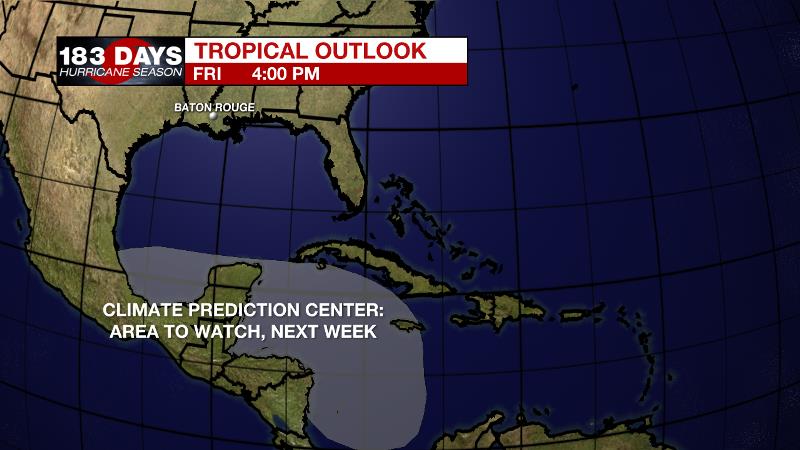
The Tropics: For the Gulf of Mexico, Caribbean Sea or Atlantic Ocean, no tropical development is expected over the next five days. However, the Climate Prediction Center has highlighted an area in the western Caribbean Sea that could provide favorable conditions for tropical development late this week, or early the following week. Be sure to visit the WBRZ Hurricane Center as we navigate all 183 Days of Hurricane Season.
Trending News
The WBRZ Weather Team is here for you, on every platform. Your weather updates can be found on News 2, wbrz.com, and the WBRZ WX App on your Apple or Android device. Follow WBRZ Weather on Facebook and Twitter for even more weather updates while you are on the go.
More News
