

Latest Weather Blog
Saturday PM Forecast: Temperatures fall into the 30s overnight, patchy frost possible
The Forecast:
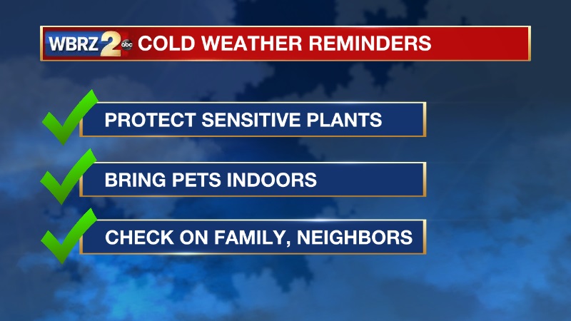
Tonight is a time to turn the heater on for the first time this season (if you haven't already).
Overnight, winds will turn calm and skies will be clear. Those are optimal conditions for cooling. We also have a very dry air mass overhead.
Southwest Mississippi and Florida Parishes: Low temperatures will drop to the mid and lower 30s. This is where frost is most likely to form.
Metro Baton Rouge: Expect lows to be between 35-37 degrees. Patchy frost will be possible, especially north of the interstates.
Coastal Parishes: Low temperatures will be in the upper 30s to low 40s.
Looking Ahead:
Temperatures will quickly rebound on Sunday. High temperatures will warm back to the upper 60s in the afternoon, under a sunny sky. A warming trend will continue through next week. Afternoon temperatures will return to the upper 70s again by Wednesday, before another cold front arrives on Thursday.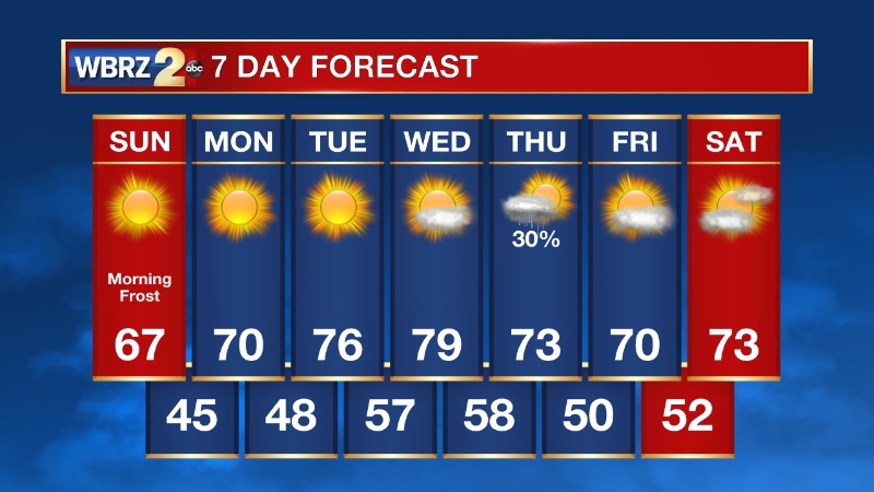
Trending News
Remember, you can always get the forecast and a look at current radar on the free WBRZ WX app!
More News
