

Latest Weather Blog
Likely the last gasp for chilly air
If you like it cool, enjoy the next few days. There are signs that this is it prior to the return of familiar late spring warmth.
THE FORECAST:
Today and Tonight: Contrary to Sunday, your Monday will offer plenty of sunshine, especially early. Highs temperatures will top out near 65 degrees. Late in the afternoon hours, clouds will build up and a passing shower is possible after 4pm. Showers should quickly push east this evening with clearing into Tuesday morning as lows plummet into the upper 30s.
Up Next: Surface high pressure will dominate area weather through Wednesday. Look for a lot of sunshine both days with below average temperatures through Wednesday morning. The dry spell will not last long, as another system begins to approach our area through midweek, initially showing up as returning high clouds on Wednesday afternoon. Highs will be back in the upper 70s Thursday, but showers and strong thunderstorms will also be likely.
Trending News
After arrival, this system will stall, keeping showers in the forecast through Saturday until the next front comes into play later in the weekend. Highs in the 80s look likely Saturday, well into next week.
With spring beginning, we get the unfriendly, sneezing reminder that pollen season is upon us. You can get an updated allergy report each weekday morning on 2une In and every day from the WBRZ Weather Facebook and Twitter pages.
The Mississippi River: At Baton Rouge, major flood stage continues with a level of 43.4’ as of Monday morning. Peaking at 44.1’ on March 19, the river set its 7th highest recorded crest at Baton Rouge. In addition, at 86 days this is now the 4th longest period above flood stage. Due to river flooding and drainage north of the area, runoff will keep the river high for many days to come. The high water is primarily an issue for river traffic and river islands, although some inundation will continue unprotected low-lying areas. Agricultural operations will be impacted on the west side of the river. The grounds of the older part of Louisiana State University's campus become soggy. This includes the area around the Veterinary Medicine building, the Veterinary Medicine Annex, the stadium and ball fields. The city of Baton Rouge and the main LSU campus are protected by levees up to 47 feet. Some seepage may be noted due to the long duration of high water placing pressure on the levees. Water from the extensive Missouri River flooding across the Upper Midwest will not reach Baton Rouge until April and the Mississippi River is expected to have fallen some by that time. As some of the Mississippi River diverts into the Atchafalaya River, gauges at Krotz Springs and Morgan City will stay high as well. Like Big Muddy, this is expected to be a prolonged event but is not uncommon for the time of year. Read more HERE.
THE EXPLANATION:
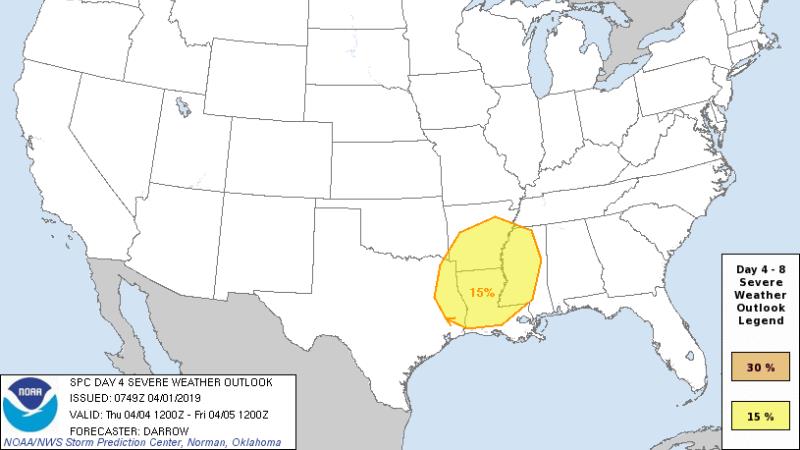
A weak upper level trough is swinging through the Lower Midwest and is expected to reach the local area later this afternoon. It will bring a patch of clouds and possibly a light shower after 4pm, especially north of I-10. Any activity will be brief and light. A reinforcing cold front will blow across the area as well with north winds and clearing skies resulting in another cold night with many lows dipping into the upper 30s and low 40s. A surface high pressure system will promote diverging surface winds and subsiding air leading to an all clear Tuesday with a fast warmup from a chilly morning. By Wednesday afternoon, the high will shift east and onshore flow will commence. Moisture will build ahead of a cold front set to enter the region on Thursday. First, enough instability and wind shear is expected to allow the possibility of severe thunderstorms, especially north of I-10. Second, a longer duration of high rain chances suggests that 1-3 inches of precipitation across the area late in the week. Another upper trough will follow over the weekend brining rain chances back up by Sunday. High temperatures will ease into the 80s toward the end of the forecast period and there are signs that they will stick around well into next week and likely beyond.
With 39° in #BatonRouge on this Monday morning, savor this chilly air if you enjoy it. There are signs that this could be the last gasp along the central Gulf Coast. pic.twitter.com/rFD95Urd9I
— Josh Eachus (@DrJoshWX) April 1, 2019
--Josh
The WBRZ Weather Team is here for you, on every platform. Your weather updates can be found on News 2, wbrz.com, and the WBRZ WX App. on Apple and Android devices. Follow WBRZ Weather on Facebook and Twitter for even more weather updates while you are on the go.
More News
