

Latest Weather Blog
Daylight reveals storm damage, is there more to come?
Severe thunderstorms swept through the region Late Thursday and Early Friday taking down trees and cutting off power to thousands. For more on the impressive storm complex, known as a Mesoscale Convective System (MCS), visit WBRZ Weather on Facebook.
One final round of showers and thunderstorms may kick up today as a cold front passes through the region. Severe weather is not anticipated.
THE FORECAST:
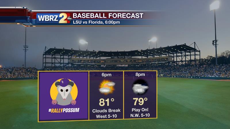
Today and Tonight: Scattered showers and thunderstorms will linger through the first half of Friday, especially for areas south and east of Baton Rouge. However, the threat for severe weather has passed. Expect the chance for rain to diminish from northwest to southeast by mid-afternoon as a cold front slips toward the Gulf of Mexico. Some sun may even return prior to dusk--but clouds through much of the day will hold highs in the low 80s. Alas, Baseball at the Box WILL be able to play tonight as clearing begins in the evening and continues overnight. Lows will be in the mid 60s.
Up Next: The unsettled pattern will break this weekend—bringing another nice two day stretch for outdoor activity. Of course, more afternoon sunshine will lead to warmer temperatures with highs in the upper 80s Saturday and Sunday. On the other hand, humidity will be ratcheted down a notch. A similar forecast will go up on the board for Monday.
THE SCIENCE:
Trending News
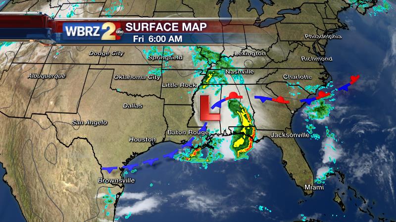
Forecast Discussion: The axis of an upper level trough will move across the region today. After widespread early morning storms, showers and thunderstorms will become scattered into the late morning and early afternoon hours as an associated surface low and cold front traverse the region. Once the trough axis and front exit eastward, drier air will filter in aloft and showers should begin to wrap up with clearing expected overnight. A weak ridge will build over the region Saturday through Monday. In addition, a high pressure will be positioned over the Ohio Valley maintaining a northerly component to surface winds. The combination will bring a drier atmosphere and less humidity. Mainly clear skies with lows in the mid 60s and highs in the upper 80s will be the trend. By the middle of next week, as the ridge retreats west, cooler northwesterly winds aloft riding over top of a return flow at the surface may allow for a few marine breeze showers to spark during peak heating hours.
--Josh
For updates, stay connected with Meteorologist Josh Eachus:
More News
