

Latest Weather Blog
Thursday morning video forecast
Related Story
The summer sizzle is officially back! Lots of sunshine and low rain chances will cause highs to hit the mid-90s on a daily basis. In the tropics, there are now two areas that have chances of tropical formation.
Today & Tonight: Following a calm morning, mostly clear skies will dominate the Capital Area today, driving temperatures up to a high of near 93°. High humidity levels will drive our peak heat index into the triple digits. While a spotty shower or thunderstorms cannot be ruled out, the overwhelming vast majority will stay dry. Skies remain mostly clear overnight as we drop to a low of 74°.
Up Next: A dry air mass and ridge of high pressure will limit storm development across the region through the weekend and much of next week. Don't be surprised if your neighborhood stays completely dry over the next seven days. A prolonged period of high heat will settle in, with daytime highs in the mid-90s and overnight lows in the mid-70s. Daily heat index values will exceed 100° each afternoon, likely remaining just below the official Heat Advisory criteria of 108°. As a reminder, practice heat safety by staying hydrated and limiting strenuous outdoor activities to the early morning or evening hours.

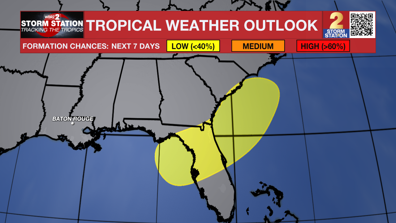
The Tropics: The National Hurricane Center recently highlighted two areas to watch across the Atlantic Basin — one closer to home, and another way out at sea.
Northeastern Gulf — An area of low pressure is expected to form during the weekend in the eastern Gulf. Subsequent slow development of this system is possible early next week, provided it stays over open water long enough. As of now, there is a low, 20% chance of tropical development. This system is likely to remain well east of southeast Louisiana, and it may actually play a role in keeping our local weather dry. Meanwhile, widespread heavy rain is expected across the eastern Gulf and parts of Florida through the weekend and into next week. The next name up is Bertha.
Eastern Tropical Atlantic — Showers and thunderstorms associated with a tropical wave located
southeast of the Cabo Verde Islands remain disorganized. Some slow development is possible during the next couple of days while the system moves generally west-northwestward at about 10 mph. By this weekend, the system is forecast to move into a less conducive environment, and further development is not expected.
Get the latest 7-day forecast and real-time weather updates HERE.
Watch live news HERE.
— Balin
The Storm Station is here for you, on every platform. Your weather updates can be found on News 2, wbrz.com, and the WBRZ WX App on your Apple or Android device. Follow WBRZ Weather on Facebook and X for even more weather updates while you are on the go.
News

