

Latest Weather Blog
Saturday Morning Forecast
Related Story
GAME DAY!
THE FORECAST
Today & Tonight: Today is the day! The Capital City Cat Fight is happening now and weather will be cooperative at times. Waking up this morning to some areas with dense patchy fog. Fog will begin to lift as the sun comes out. Temperatures will remain comfortable in the 70s for most of the morning. Daytime highs will reach the mid-to-upper 80s this afternoon. Expecting mostly sunny skies this morning in your forecast, but some clouds will begin to build into the area during the afternoon hours. Showers and storms are possible today. Not expecting a total washout but with thousands of people planning to be outdoors tailgating, be sure you have a way of getting information. Showers will develop and move out of the area quickly, however gusty winds, frequent lightning, and heavy downpours are possible. By the time we get to kick off showers should be well out of the area but the clouds will stick around into the overnight hours.
Up Next: Sunday-Funday! We will finally begin to transition into a new weather pattern… and this one I guarantee you will like! Waking up Sunday morning expect more of the same low-70 temperatures with mostly sunny skies. A cold front approaching the area will bring in northerly winds and some much needed drier air into the area. Forecast highs will top out near 90°. Sunday will be a drier day but isolated showers are still possible. Overnight once the front passes, we will be waking up to a cooler drier start for your Monday. For the work week the new pattern stays locked in. Temperatures will max out in the upper-80s low-90s throughout the week. Plenty of sunshine and dry time is expected for the workweek. Click here to see the 7-day forecast.
Hour-by-hour weather tracking is available for your location on the WBRZ WX App on your Apple or Android device. Follow WBRZ Weather on Facebook and Twitter for even more weather updates and unique weather insight from the whole team!
In the Tropics:
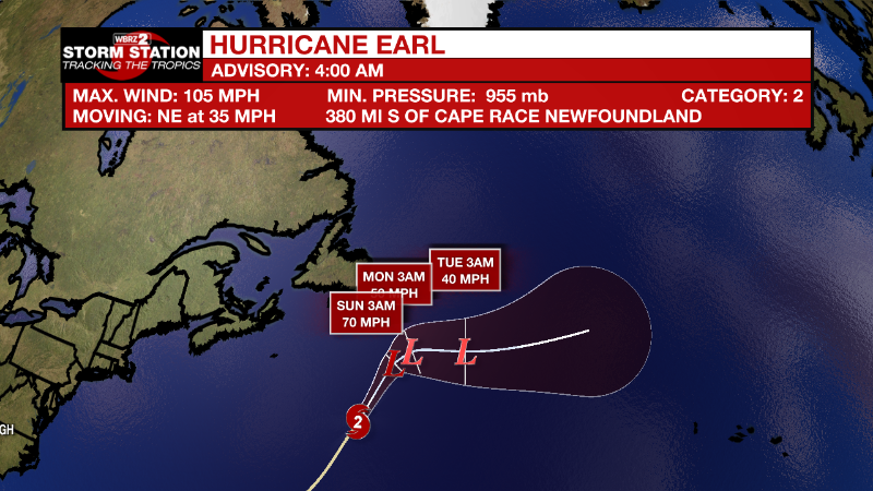
No current threats to the United States and no developments expected to impact the Gulf coast at this time.
Hurricane Earl still maintaining hurricane strength overnight. This system will continue to weaken as it moves into a less favorable environment in the northern Atlantic.
Eastern Tropical Atlantic:
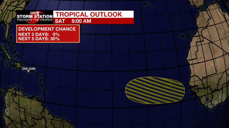
A tropical wave is forecast to move off the west coast of Africa
on Monday. Gradual development of the wave will be possible during
the early to middle part of next week while it moves westward or
west-northwestward across the eastern tropical Atlantic Ocean.
* Formation chance through 48 hours...low...near 0 percent.
* Formation chance through 5 days...low...30 percent.
News
