

Latest Weather Blog
Tuesday PM Forecast: pleasant weather as attention moves to tropical disturbance ahead of weekend
Nice weather will stick around the Baton Rouge Area for most of the workweek, bringing comfortable mornings and warm, partly sunny afternoons. However, the focus will be on a developing tropical system with the potential to bring wet and breezy weather by late Friday through the weekend.
Midweek Calm: lower humidity, afternoon sunshine
Weekend Rain: just a possibility, depends on track of tropical system
Watching the Gulf: future Isaias to target area between southeast Louisiana and Florida Panhandle
Tonight, Tomorrow and Thursday: Expect increasingly more comfortable conditions across the Capital Area tonight as cooler, less humid air settles in behind a stalled front. Look for low temperatures to drop into the mid-to-upper 60s under mostly clear skies, making for a refreshing start to your morning commute. Wednesday will be mostly sunny and dry, with humidity down a few notches even compared to Tuesday. The high temperatures should top out in the upper 80s. Rain chances will remain near zero for inland parishes, though coastal waters and immediate shoreline communities may spot a few brief showers.
.png)
Trending News
Up Next: As of now, the Storm Station forecast shows rain coverage creeping back up late Friday and through the weekend as another wave of tropical moisture rolls in. However, understand that this forecast is not locked in yet since it is tied to possible tropical development in the Gulf. The exact track will be the deciding factor. A path closer to home could spell out a much wetter weekend, while a track farther east would quickly cut off rain chances from west to east. If you have outdoor weekend plans, keep connected to us for daily updates, as the exact track of the tropical system will determine the outcome. Once the system passes, weather models indicate drier conditions will return early next week, bringing afternoon temperatures back into the upper 80s to near 90 degrees.
Get the latest 7-day forecast and real-time weather updates HERE.
Watch live news HERE.

The Tropics: The National Hurricane Center has designated Invest 92L in the southwestern Gulf where thunderstorms have been organized, and surface pressure has been falling. Atmospheric conditions in the southern Gulf are ideal for tropical development, and Tropical Storm Isaias is expected to form later this week.
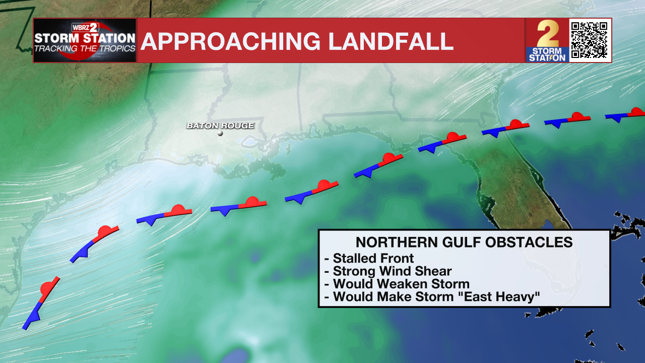
The system will move slowly eastward before making a sharp turn toward the north or northeast, targeting the Gulf Coast between Friday and Saturday. As the storm moves north, it will run into high-altitude wind shear, which will eventually cap the storm's intensity and push most of the heavy rain to the eastern side of the center.
Reconnaissance Hurricane Hunter aircraft are actively flying into the storm to collect real-time data, which will give us a much clearer picture of the exact track over the next 24 hours. Expect more shifts in forecast track and intensity within that period until the better data arrives.
– Josh
The Storm Station is here for you, on every platform. Your weather updates can be found on News 2, wbrz.com, and the WBRZ WX App on your Apple or Android device. Follow WBRZ Weather on Facebook and X for even more weather updates while you are on the go.
More News

