

Latest Weather Blog
Tuesday PM Forecast: heat dominates until widespread storms return Thursday
While a stray shower or thunderstorm is still possible, heat will continue to be the main weather story on Wednesday. An approaching front will reintroduce much higher rain coverage to end the week.
Next 24 Hours: Any clouds from the day will quickly diminish overnight. Southwest winds of 5mph will keep low temperatures above average and in the upper 70s. Another hot afternoon is ahead on Wednesday as high temperatures run for the mid 90s. Ample humidity will again ensure feels-like temperatures move well over 100 degrees for several hours. Partly sunny skies will give way to a few showers and thunderstorms late in the afternoon or into the evening—especially north of I-12.
Up Next: Substantial changes will come on Thursday as a moist, tropical air mass takes hold once again. A weakening front stalling around or just south of I-20 will remain in place for a few days. Through Saturday, mostly cloudy skies will give way to scattered or widespread showers and thunderstorms. Like previous episodes this summer, some localized street and poor drainage flooding could occur. The added clouds and rain will keep high temperatures in the mid to upper 80s. CLICK HERE for your detailed 7-Day Forecast.
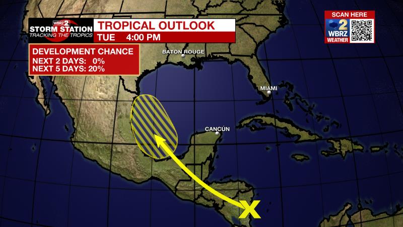
The Tropics: A tropical wave is expected to move across Central America and emerge in the Bay of Campeche or southern Gulf of Mexico later this week. There is a twenty percent chance that an area of surface low pressure could form and become a depression into the weekend.
Trending News
The Explanation With a slightly drier atmosphere overhead, relative to last week, precipitation struggled to develop around the forecast area and this should be the case through the middle of the week. While isolated convection remains possible, most neighborhoods will stay dry with heat being the dominant weather item. With high temperatures climbing into the mid 90s and dew point temperatures in the mid to upper 70s thanks to all of the recent rain, feels-like temperatures will near heat advisory criteria. A weakening front will approach the area on Thursday with deep, tropical moisture pooling in the atmosphere ahead of it. Both features will stay in place through Saturday. This combination, like last week, could result in some areas of heavy rain and localized flooding. After Saturday, the upper level trough of low pressure driving the cold front southward will escape to the east of the region. Stalled near I-20, the front will then diminish or even retreat north as a warm front. With no significant drying in the atmosphere and no ridge of high pressure to suppress convection, daily showers and thunderstorms should be in normal timing and distribution into early next week.
--Josh
The Storm Station is here for you, on every platform. Your weather updates can be found on News 2, wbrz.com, and the WBRZ WX App on your Apple or Android device. Follow WBRZ Weather on Facebook and Twitter for even more weather updates while you are on the go.
More News
