Trending drier through the weekend
Look for a transitional day of weather with areal rain coverage beginning to scale back.
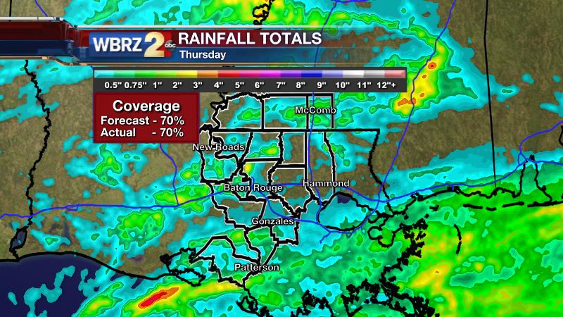
It was a good forecast yesterday. Early showers were limited to areas south of I-10, while thunderstorms developed late in the day for locations northwest of Baton Rouge. The 13 Parish, 3 County forecast area saw 70% rain coverage as expected. Fortunately, although hail was a possibility, there were no such reports with any of the evening thunderstorms.

THE FORECAST:
Today and Tonight: Friday will bring cloud cover and lingering showers though skies will reveal a few breaks of sun. Any spotty showers that do occur should be lighter and brief. Highs will make it into the upper 70s. Precipitation coverage will wane overnight with a low temperature dipping into the low 60s.
Trending News
Up Next: Over the weekend, afternoon skies are expected to be partly sunny although an isolated shower can’t be entirely ruled out—coastal areas would stand the best chance. Highs will push 80 degrees. A similar pattern will be carried through Monday and Tuesday with no organized rain foreseen through early next week.
THE SCIENCE:
Forecast Discussion: Friday presents a fairly tricky forecast. The axis of a shortwave trough should be east effectively ending uplift in the local area. However, the lingering cold pool aloft associated with that trough and some surface moisture may allow the continued development of a few showers. At the same time, the back side of the trough features much dry air which is shown to be pushing into the forecast area on the water vapor imagery which would work against shower development. In addition, upper ridging atop the leftover low level moisture may result in considerable cloudiness early Friday, but diurnal heating will help to mix this layer out to reveal some afternoon sun as well. It remains difficult to go with an all dry forecast Saturday through Monday; however the aforementioned upper ridge should put a lid on most if not all convection. Additionally, a broad surface high pressure system will be nudging southwestward from the Northeast U.S. promoting fair weather for a large chunk of the Eastern U.S. Our locale appears to be on the periphery of the surface high’s reach. An upper trough in the Southwest U.S. will loop waves of vorticity around just to our west. Should a bit of energy sneak east, enough surface moisture would be available to trigger spotty showers—especially closer to the coast. For these reasons, we may have to consider mentioning 10% rain chances through the period. The ridge and surface high will begin to break down by Tuesday and Wednesday of next week allowing return flow and the next chance for showers and thunderstorms. The specifics are a bit unclear and will be worked out as we watch deep cutoff low in the Southwest be absorbed by the sub-tropical jet stream.
Researchers at Colorado State University have released their annual tropical weather outlook for the Atlantic Basin. CLICK HERE for the full story.
For updates, stay connected with Meteorologist Josh Eachus:


