

Latest Weather Blog
TORNADO WATCH in effect, severe storms likely today
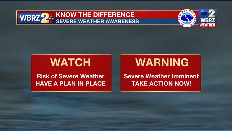
The National Weather Service has issued a TORNADO WATCH for the WBRZ Weather Forecast Area until 7PM Tuesday. This means conditions are favorable for tornadoes and/or damaging winds in and around the watch area.
TORNADO WATCH ISSUED through 7 p.m. for the entire viewing area. Stay weather aware. Updates: https://t.co/660GxIkXtD pic.twitter.com/rI6FcxRT4h
— WBRZ Weather (@WBRZweather) March 22, 2022
Be on the lookout for threatening weather conditions and listen for later statements and possible warnings. If a tornado warning is issued, seek shelter in a low-level, interior room of a sturdy building. Take pets (on a leash) with you, have on hard-soled shoes, monitor storm coverage on a wireless device and cover your head in the event of wind or tornado impact. For more on tornado safety, CLICK HERE.
Trending News
BOTTOM LINES:
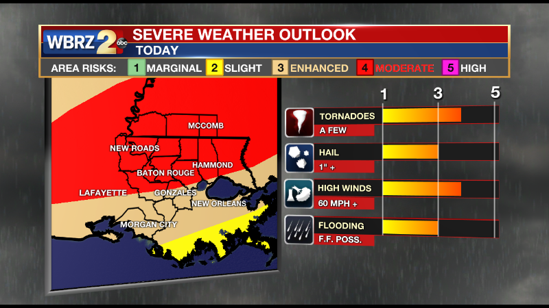
--STRONG STORMS, HEAVY RAIN - possible between dawn and dusk Tuesday, now - 6pm
--WIND ADVISORY - gusts over 30mph possible regardless of thunderstorms, tie down loose objects
--FLOOD WATCH - downpours could lead to street and poor drainage flooding
--BE WEATHER AWARE - have a way to receive alerts, know the safest place to go
THE FORECAST
Tonight and Tomorrow: Clouds will increase with a couple of showers possible ahead of the main line. It will be breezy with southeast winds of 15-20mph and locally higher gusts. Winds will stay elevated throughout Tuesday, regardless of thunderstorms. Expect south winds of 20-25mph with gusts over 40mph possible. While clouds will dominate, some breaks will be possible early. Any sunshine will serve to warm high temperatures into the upper 70s and possibly lower 80s which would only add to the "ingredients" already in favor of strong thunderstorms. A line of thunderstorms is likely to cross through southeast Louisiana and southwest Mississippi between 11am - 5pm. Thunderstorms within this line will be capable of damaging wind gusts, very heavy rain, isolated tornadoes and even some hail. If any storm cells can develop ahead of the line, they will pose a greater risk for tornadoes. Overall, 1-3 inches of rain is expected with the highest amounts along and north of I-12. Some street and poor drainage flooding could occur, but larger area rivers will be able to handle the runoff. Activity will move east by dusk with much quieter weather to follow.
WIND ADVISORY: South winds of 20-25 mph with gusts up to 30-40mph are expected until 9pm Tuesday across the entire WBRZ Weather Forecast Area. Gusty winds could blow around unsecured objects. Tree limbs could be blown down and a few power outages may result. Use extra caution when driving, especially if operating a high profile vehicle. Secure outdoor objects.
FLOOD WATCH: Flash flooding caused by excessive rainfall is possible through Tuesday evening. Rainfall totals of 2 to 4 inches with locally higher amounts can be expected. Excessive runoff may result in flooding of rivers, creeks, streams, and other low-lying and flood-prone locations.
SAFETY: Make sure you have a way to receive warnings in the event storms in your area turn severe. You can download or activate the WBRZ WX App on your Apple or Android device or turn on a NOAA Weather Radio for bulletins such as watches and urgent warnings. If a tornado warning or severe thunderstorm warning is issued, seek shelter in a low-level, interior room of a sturdy building. Take pets (on a leash) with you, have on hard-soled shoes, monitor storm coverage on a wireless device and cover your head in the event of wind or tornado impact. For more on tornado safety, CLICK HERE.
.png)
Reminder: With the threat for impactful weather, please have access to alerts through Tuesday. You can download or activate the WBRZ WX App on your Apple or Android device or turn on a NOAA Weather Radio for bulletins such as watches and urgent warnings. Of course, WBRZ, WBRZ+ and the Cable Weather Channel will have updates as active weather dictates.
Up Next: Conditions will be much quieter for the rest of the week. Afternoon high temperatures will trend near 70 degrees with overnight low temperatures in the mid 40s for the rest of the workweek. There will be a few clouds Wednesday and Thursday, but plenty of sunshine will be in the mix. Continued clear and slightly warmer weather is expected over the weekend. Click here to see the 7-day forecast.
More News
