

Latest Weather Blog
Thursday PM Forecast: after three weeks dry, multiple rain chances for Capital Area
Our first chance at measurable rain in nearly a month will arrive just in time for Halloween weekend. Looking further ahead, keep rain gear handy and stay alert for a round of thunderstorms that will sweep across southeast Louisiana around Election Day.
Halloween Trick: showers possible for the first time since early in the month
Muggy for a While: weekend into early next week
Stronger Frontal: more widespread rain, temperature tumble Election Day onward
Tonight and Tomorrow: Skies will stay mostly clear this evening before moisture begins to sneak back in overnight. Still, low temperatures will be able to fall into the upper 50s. Through Friday, the humidity will keep creeping up as winds blow in from the Gulf. The afternoon highs will push into the mid-80s. Expect puffy low-to-mid-level clouds to bubble up during the afternoon with just a spotty (20% chance) of a shower. The evening will be noticeably stickier for Friday Night High School Football than the previous two weeks, and extra layers shouldn’t be needed.
Trending News
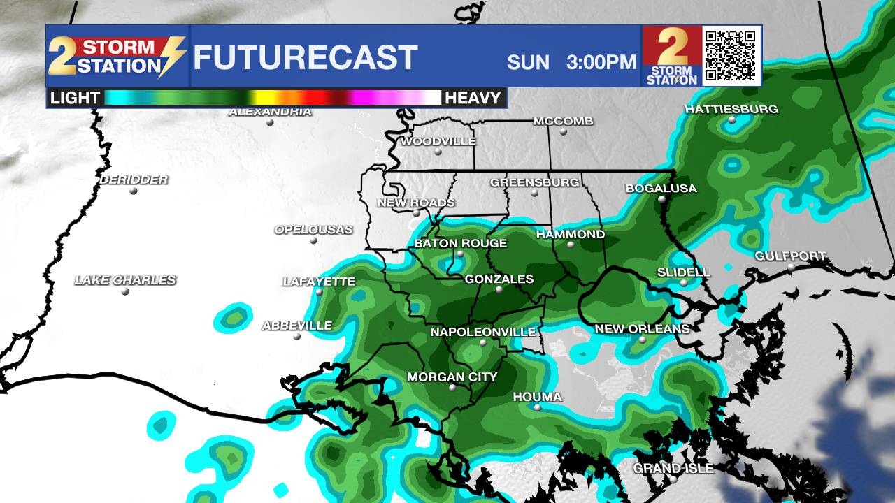
Use the slider to advance through the next 24 hours of Futurecast
Up Next: The sticky air will set the stage for a very weak disturbance in the atmosphere to move into the region on Saturday. In combination, these two variables will create scattered showers and thunderstorms—the first real chance for a few neighborhoods to measure rain since early October. Scattered is an important word right now, as this does not have the makings of a major rain event, and there could be some spots that miss the showers. While the rain is the good news, the timing is the bad news. Showers on Halloween could mean costumes could get damp for some trick-or-treaters. The showers will be speckled on the map, so there will be a bit of luck as to what spots get wet versus what spots stay dry. Rain amounts will be limited and will not provide major relief to the drought situation.

As a reminder, set those clocks back one hour before bed on Saturday night! On Sunday, a warmer sinking air mass in the atmosphere will shut down organized showers and allow some sun to break through. Expect highs for the end of the weekend and early next week to soar into the upper 80s, and thanks to lingering humidity, lows will be muggy in the mid-60s.
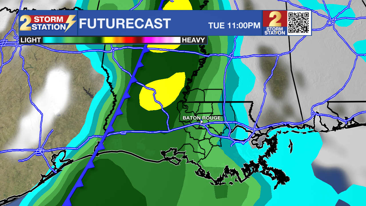
By Tuesday afternoon into Wednesday morning—surrounding Election Day—a powerful storm system will barrel across the Gulf South. Unlike the weekend showers, this system will have the necessary support in the atmosphere for more widespread rain and thunderstorms. Expect rain coverage to ramp up Tuesday afternoon and increase overnight Tuesday night, persisting into Wednesday morning. Once the front clears Wednesday evening, it will usher in crisp, dry air, dropping daytime highs into the upper 70s and overnight lows into the 50s.
Get the latest 7-day forecast and real-time weather updates HERE.
Watch live news HERE.
The Tropics: The Gulf, Caribbean, and broader Atlantic Basin will remain completely quiet. Tropical cyclone formation is not expected over the next 7 days.
– Josh
The Storm Station is here for you, on every platform. Your weather updates can be found on News 2, wbrz.com, and the WBRZ WX App on your Apple or Android device. Follow WBRZ Weather on Facebook and X for even more weather updates while you are on the go.
More News

