

Latest Weather Blog
Take your pick
After showers and thunderstorms rolled through the area Thursday Afternoon, many locations were treated to a beautiful rainbow and sunset. For more of your photos, check out the WBRZ Weather Facebook Page. The culprit for those showers, a weak cold front, will push through the region today, ending rain chances just in time for a weekend packed with outdoor events in the Baton Rouge area.
THE FORECAST:
Today and Tonight: Spotty, light showers may linger—especially early as a weakening cold front slides across the area. After morning fog dissipates, skies are expected to clear from northwest to southeast through the day. Highs will make it into the low 80s. Continued clearing is expected overnight with a low temperature dropping to near 60 degrees.
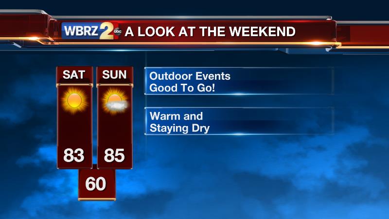
Up Next: The weekend will bring quiet and clear mornings with lows in the low 60s followed by mostly sunny and warm afternoons. Saturday will have high temperatures running into the low 80s while Sunday will be a touch warmer in the mid 80s. The next chance for a shower or thunderstorm comes on Monday, but it does not look like a major weather event.
Trending News
THE SCIENCE:
Forecast Discussion: The nuisance upper trough that has brought persistent unsettled weather to the Mid-South since Monday will eject eastward today. As the axis pushes across the Gulf Coast, it will drag a cold front through the region. Showers will remain ahead of and along the front, therefore rain chances will be trimmed from north to south as the boundary movement allows. Obviously, a faster passage would result in quicker clearing and more afternoon sun. Over the weekend, a weak mid-level ridge will be enough to keep the region dry and warmer than average. Both weekend days will bring sunshine and highs in the mid 80s. Forecast models are now showing a fast-moving and weaker shortwave crossing the area on Monday. Current solutions suggest no more than isolated to scattered showers and thunderstorms. Beyond that, most of the jet stream energy will lie well north of the region allowing a quiet and quite warm middle part of next week. Highs could be 5-10 degrees above average with upper 80s possible Tuesday – Thursday.
For updates, stay connected with Meteorologist Josh Eachus:
More News
