

Latest Weather Blog
Sunday PM Forecast: Rain chances go up mid-week, heavy rain possible Thursday
TONIGHT & TOMORROW
Sunday was beautiful with high temperatures in the middle and upper 60s!
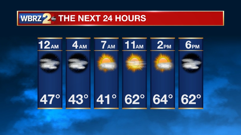
Tonight will be chilly, but not as cold as the previous two nights. Overnight temperatures will be in the upper 30s and low 40s.
Monday, expect an increase in cloud cover through the day, all ahead of our next storm system. High temperatures will be in the upper 60s.
LOOKING AHEAD
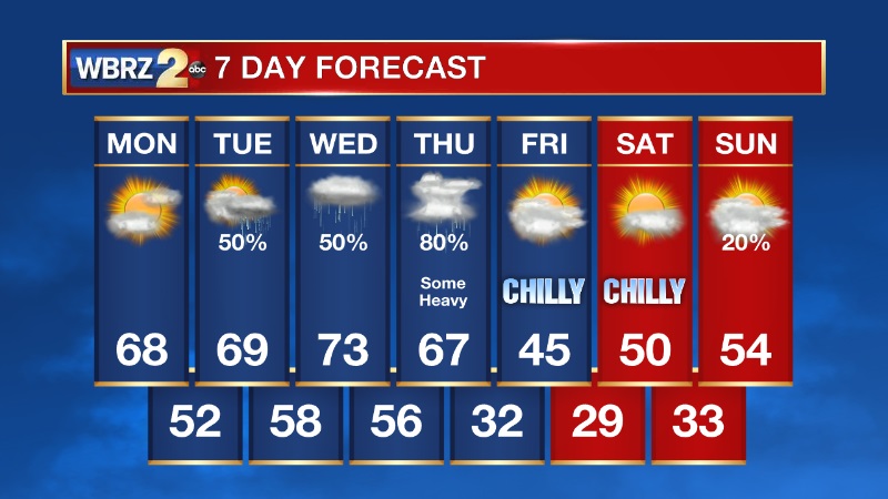
Our weather pattern will turn more active this week with several chances for rain. Scattered showers are expected on Tuesday & Wednesday but nothing overly active. Thursday, a potent cold front will sweep across the region bringing widespread showers and thunderstorms - a few of which may be strong and could also produce heavy rainfall. Over the next seven days 1-3 inches of rainfall is expected on average across south Louisiana and southwest Mississippi. That is manageable stretched out over time but we will need to watch for pockets of heavy rain, especially on Thursday.
-- Meteorologist Jake Dalton
CLICK HERE to download the WBRZ WX APP on Apple devices.
Trending News
More News
