

Latest Weather Blog
Saturday AM Forecast: More rain expected today, PLUS a tropics update
More rain expected for the Capital Area this weekend.
THE FORECAST
Today & Tonight: Waking up to some showers creeping into the area to start your Saturday. As the day continues on more clouds will begin to build in and your rain chances start to go up into the afternoon hours. Temperatures across the area will be dependent on when and where showers set up. Daytime highs will be in the low-90s. Plenty of moisture will have heat index values nearing triple digits today. Showers will be around the area by lunch and sticking around until the late afternoon hours. Most people will see a shower today. With these showers and storms frequent lightning, gusty winds, and a heavy downpour is possible. Rain will be well out of the area before any Saturday night dinner plans. Cloud cover will linger into the overnight hours and temperatures will fall into the mid-to-low 70s.
Up Next: The same wet pattern is set to continue for Sunday. A shower could be around in the early morning hours, temperatures will be in the mid-to-low 70s. Throughout the day temperatures will rise into the high-80s, low-90s across the Capital Area. Showers and storms are more likely during the afternoon hours. Showers activity will begin to calm down as the sun begins to set. More people have a greater chance at seeing rain on Sunday. Temperatures will be back in the mid-70s for the start of your workweek. The rainy forecast will not be going anywhere anytime soon. Daytime highs will be in the upper-80s but dependent on when and where showers set up across the area. Monday and Tuesday shaping up to be the wetter days of the week. Click here to see the 7-day forecast.
Reminder: Be sure you are staying connected to stay ahead of these showers and storms. Hour-by-hour weather tracking is available for your location on the WBRZ WX App on your Apple or Android device. Follow WBRZ Weather on Facebook and Twitter for even more weather updates and unique weather insight from the whole team!
Trending News
In the Tropics:
NEW: the first track on Potential Tropical Cyclone Four. This system is not a threat to our area.
— Josh Eachus (@DrJoshWX) August 19, 2022
***The P.T.C. designation allows NHC to issue watches/warnings/advisories on a system that is not yet formed, but expected to and impact land within 48 hours*** pic.twitter.com/oOE7C1YI8Y
As of 4pm Friday, the National Hurricane Center started issuing advisories on Potential Tropical Cyclone Four. It currently has 35mph winds with a minimum central pressure of 1010mb and is moving northwest at 14mph. On the forecast track, the disturbance is expected to approach the coast of northeastern Mexico on Saturday and make landfall there Saturday night. Slow strengthening is expected through landfall, and the disturbance is forecast to become a tropical storm tonight.
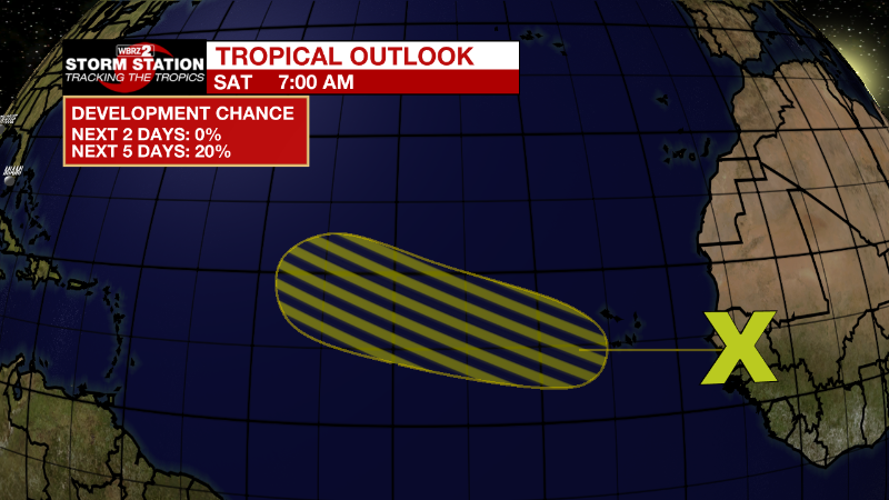
Eastern Tropical Atlantic:
A tropical wave is forecast to move off the west coast of Africa
later today and tonight. Environmental conditions are expected to
be marginally conducive for gradual development of this system
while it moves west-northwestward to northwestward at 15 to 20 mph
across the eastern and central tropical Atlantic during the early
to middle part of next week.
* Formation chance through 48 hours...low...near 0 percent.
* Formation chance through 5 days...low...20 percent.
More News
