

Latest Weather Blog
Heat returns, increasing showers this weekend
Around the United States, big heat will be the big story for the remainder of the week. Many large metropolitan areas from the Midwest to East Coast face high temperatures near 100 degrees with even higher “feels-like” temperatures. Locations from Oklahoma City to Omaha to Kansas City to St. Louis and even Philadelphia are under an Excessive Heat Warning.
THE FORECAST:
Today and Tonight: Similar to Wednesday, this afternoon will have temperatures climbing into the low 90s by 1pm followed by a high temperature near 94. Some clouds will bubble up and a slightly more active sea breeze may help to activate some isolated showers and thunderstorms by mid-afternoon. Overnight, any activity will ease with a low temperature near 75.
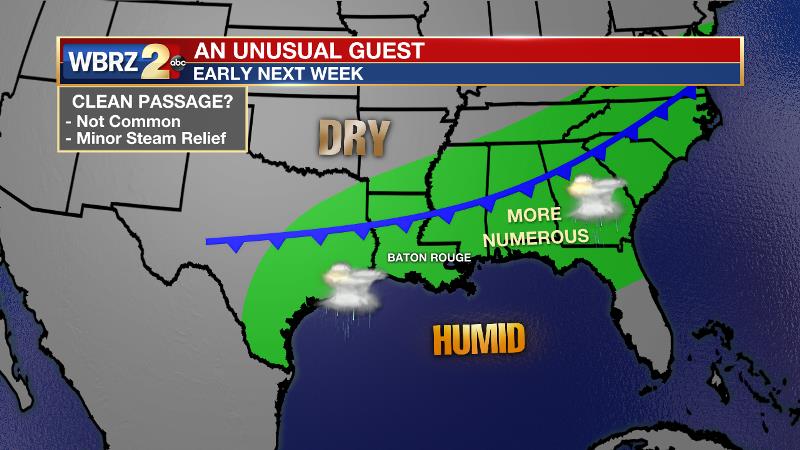
Up Next: By the weekend, a bit more instability in the atmosphere may allow for a slight uptick in shower and thunderstorm development, especially during the afternoons. Highs may stop just a degree or two shy of average as a result. Into early next week, it appears as though a weak front could backdoor into the region. As you might imagine, adding a trigger in the form of a front to July steam will allow for more numerous showers and thunderstorms to occur. It is still unclear if this front will be able to scrape through the region to provide a slight reduction in humidity.
Trending News
The Tropics: The Gulf of Mexico, Caribbean Sea and Atlantic Ocean are quiet. No tropical development is expected over the next 5 days.
The Mississippi River: At Baton Rouge, major flood stage continues with a level of 42.2’ as of Wednesday morning. Peaking at 44.1’ on March 19, the river set its 7th highest recorded crest at Baton Rouge. At 193 days, this year marks the longest period above flood stage at Baton Rouge. The level will slowly fall, but is likely to stay above flood stage for several weeks to come. The high water will remain an issue for river traffic and river islands, although some inundation will continue for unprotected low-lying areas. The city of Baton Rouge and the main LSU campus are protected by levees up to 47 feet. Some soggy areas and seepage may be noted due to the long duration of high water placing pressure on the levees. As some of the Mississippi River diverts into the Atchafalaya River, gauges at Krotz Springs and Morgan City will stay high as well. This creates backwater flooding in parts of Assumption Parish in areas such as Bayou Chene, Stephensville and around Lake Palourde.
THE EXPLANATION:
A broad upper level ridge will stay over the region through Thursday. Both the American and European forecast models are picking up on an inverted trough traversing the Gulf of Mexico beneath this broad ridge over the weekend. Due to this, an increase of showers and thunderstorms can be expected, but should follow the normal timing pattern. An actual cold front may make a visit by early next week and so we will add greater rain coverage to the 7-Day Forecast on Tuesday. At the moment, severe weather chances look low regarding this front. However, it is a long way out so that could change as we move closer. Fronts getting this far south without being strongly modified are rare to say the least, so a big cool down is not anticipated. Dew points could drop enough to allow overnight low temperatures to nudge below average.
--Josh
The WBRZ Weather Team is here for you, on every platform. Your weather updates can be found on News 2, wbrz.com, and the WBRZ WX App. on Apple and Android devices. Follow WBRZ Weather on Facebook and Twitter for even more weather updates while you are on the go.
More News
