

Latest Weather Blog
Friday AM Forecast: Quiet and hot over weekend, heavy rain threat next week
Although the weather will be fairly quiet over the weekend, it will be a hot one with peak feels like temperatures near 105°. Next week, the pattern changes in dramatic fashion, as a heavy rain threat emerges.
Today & Tonight: Friday will continue the rinse and repeat weather pattern, although a gradual influx of tropical moisture will lead to a bit more humidity. Skies will remain partly sunny, with daytime heating triggering isolated afternoon showers and thunderstorms, primarily concentrated south of the I-12 corridor. Expect afternoon highs to peak near 93°, but when combined with the rising humidity, heat indices will easily climb into the triple digits. Make sure to drink plenty of water! Moving into the overnight hours, skies will clear out somewhat as temperatures settle into the mid-70s.
.png)
Up Next: The intense heat will remain firmly entrenched across the region through the upcoming weekend. As humidity levels steadily climb, heat indices are projected to exceed 100°, potentially approaching the 108° threshold for an official Heat Advisory. Storms will fire in the afternoons, but coverage will remain isolated. Because these storms are driven entirely by daytime heat rather than a major weather system, any activity that develops will quickly dissipate after sunset.
Trending News
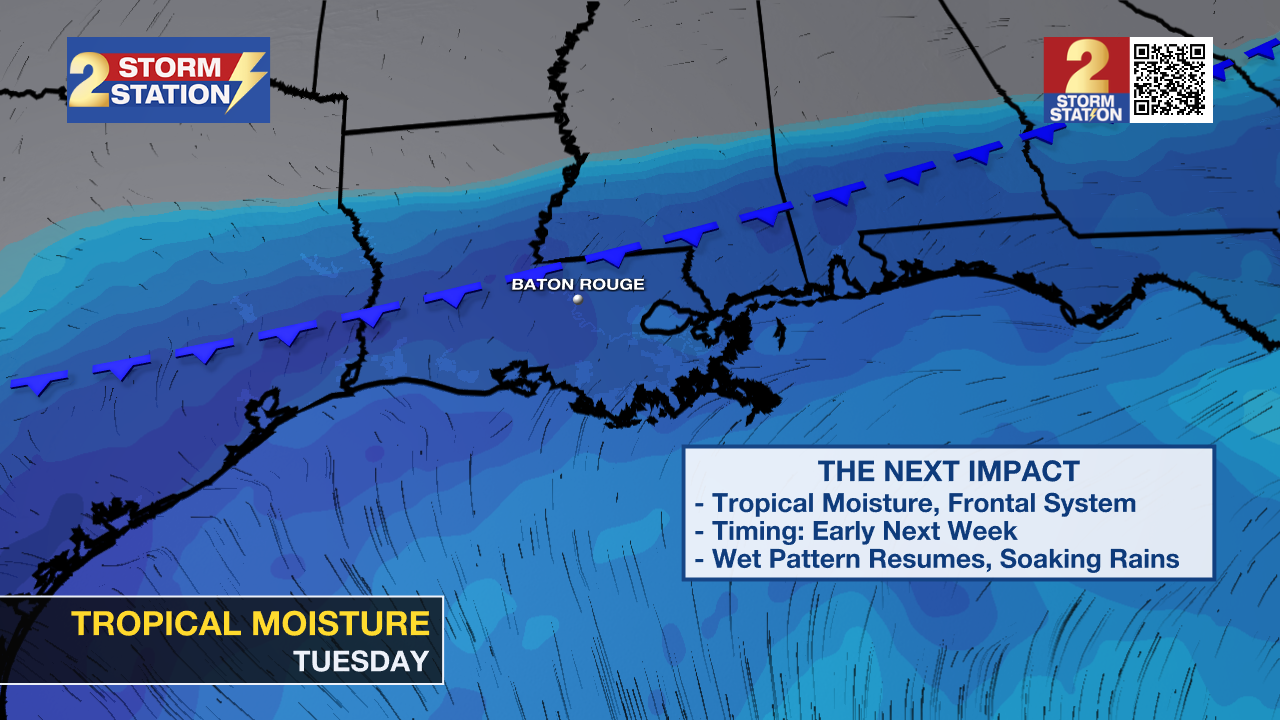
A shifting weather pattern is anticipated by the end of the weekend as a weak front approaches the area. Ahead of this system, an increase of deep tropical moisture will set the stage for a prolonged period of unsettled weather early next week. The front is projected to stall directly over northern Louisiana on Monday, serving as a focal point for repeated rounds of heavy thunderstorms from Monday through at least Wednesday. Rain coverage will escalate sharply to 70% on Monday, peak at 90% on Tuesday, and remain high at 60% on Wednesday. Widespread rainfall totals of 3 to 6 inches are expected over this three-day period, with localized pockets potentially seeing nearly double those amounts. Reflecting this threat, the National Weather Service has already placed the region under a Level 2/4 "Slight Risk" for excessive rainfall on Monday and Tuesday.
Get the latest 7-day forecast and real-time weather updates HERE.
Watch live news HERE.
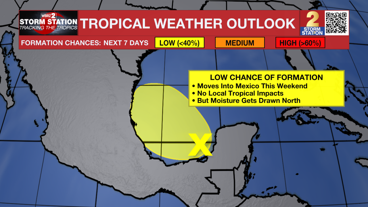
The Tropics: Disorganized showers and thunderstorms are occurring over the Yucatan Peninsula and the adjacent Bay of Campeche, and a broad area of low pressure is expected to form in this area later today. Environmental conditions are forecast to be only marginally conducive for development before the system moves inland over eastern Mexico late Saturday or Sunday.
– Balin
The Storm Station is here for you, on every platform. Your weather updates can be found on News 2, wbrz.com, and the WBRZ WX App on your Apple or Android device. Follow WBRZ Weather on Facebook and X for even more weather updates while you are on the go.
More News
