

Latest Weather Blog
Friday AM Forecast: A little more dry time this weekend
Another rainy afternoon today, but there is more dry time in the forecast this weekend.
THE FORECAST
Today & Tonight: Your Friday is bringing another round of widespread showers and storms. Most areas will see rain today with a few heavy downpours possible. Most of the rain will be in the afternoon, but like yesterday, a few spots may get a light shower this morning. Between the showers, temperatures will max out in the upper 80s. Shower activity will die down in the evening and Friday night plans should be nice and dry. Overnight temperatures will be in the low 70s. There is much more dry time in the weekend forecast.
Up Next: On Saturday, about half of the area will see measurable rainfall. That rain will be in the afternoon hours. On Sunday, most locations will stay dry with only 30% of the area expected to see rain. The slightly drier trend will continue into the first half of next week. With less rain, the temperatures will be a bit higher. Temperatures will continue to trend in near 90° with the heat index near 100°. The rainy afternoons will come back in full force by Wednesday. Get out and enjoy any sunshine you have! Click here to see the 7-day forecast.
Reminder: With the threat for impactful weather— street and poor drainage flooding —please have access to alerts through this week. You can download or activate the WBRZ WX App on your Apple or Android device or turn on a NOAA Weather Radio for bulletins such as watches and urgent warnings. Of course, WBRZ, WBRZ+ and the Cable Weather Channel will have updates as active weather dictates.
In the Tropics:
Trending News
The low pressure that has been bringing us rain all week is on it's way to Texas. It has a 10% chance of developing into a tropical depression, but it will not be a rainmaker locally. As it moves closer to Texas, we will dry out!
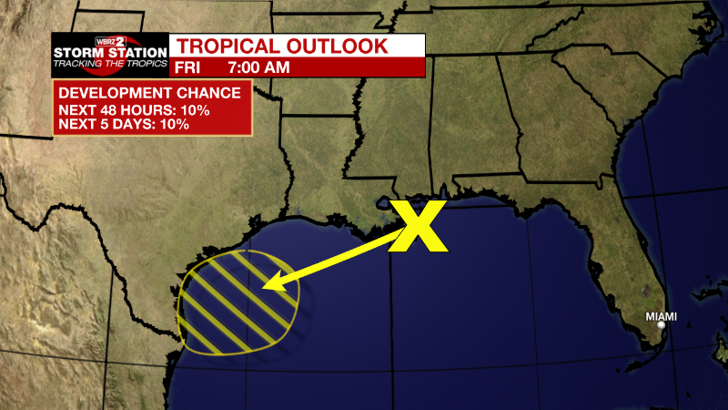
Northern Gulf of Mexico: A surface trough of low pressure is developing over the north-central Gulf of Mexico just offshore of southeastern Louisiana. Development, if any, of this system is expected to be slow to occur during the next couple of days as it drifts west-southwestward over the northwestern Gulf of Mexico. Regardless of development, locally heavy rains are possible along portions of the Texas coast through the weekend. For more information about the potential for heavy rainfall, please see products issued by your local National Weather Service office and the Weather Prediction Center.
* Formation chance through 48 hours...low...10 percent.
* Formation chance through 5 days...low...10 percent.
More News
