Drought conditions continue to worsen across the Capital Area
After another abnormally dry month across the Capital Area, the drought monitor continues to worsen. All of the WBRZ viewing area is now under a moderate drought.
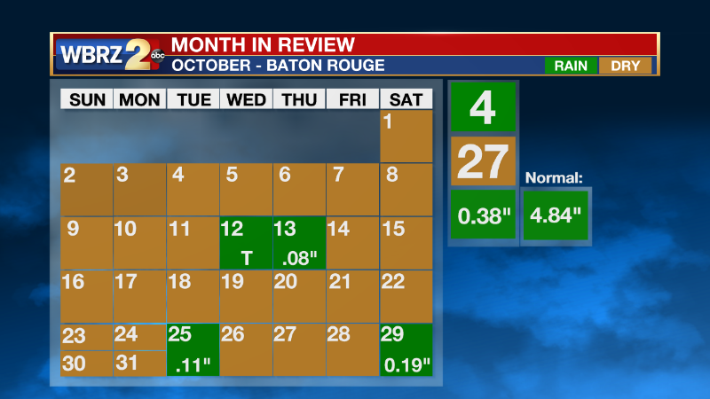
For October, we only saw 4 total days with rain, one of them with only trace amounts recorded. Typically we see 4.84” of rain throughout October, but this month we only saw 0.38”.

Usually, by this time of year, we have seen 52.86 inches of rainfall. So far for 2022, we have only seen 39.25 inches.
Trending News
There are five classifications of drought.
D0- Abnormally Dry
D1- Moderate Drought
D2- Severe Drought
D3- Extreme Drought
D4- Exceptional Drought
Drought conditions are usually uncommon for our area, but this year we have been no stranger to the lack of rainfall. Under an extreme drought grass stops growing, trees are stressed and creeks and bayous are low.
The Mississippi River is at strikingly low rates all across the US, but here at home, the low water levels have uncovered an early-century shipwreck. For more information on the finds, VIEW HERE.
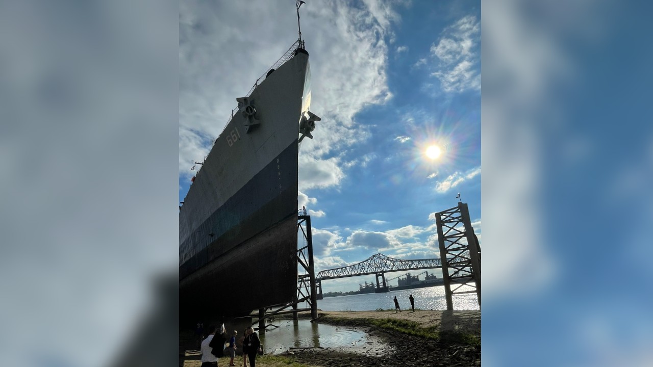
If you walk the levee downtown, you will see the USS Kidd. The Kidd is normally sitting in the water, but now sitting fully above the land. With the low water levels, workers have been able to inspect the exterior of the ship, you can read more about what has to be done HERE.

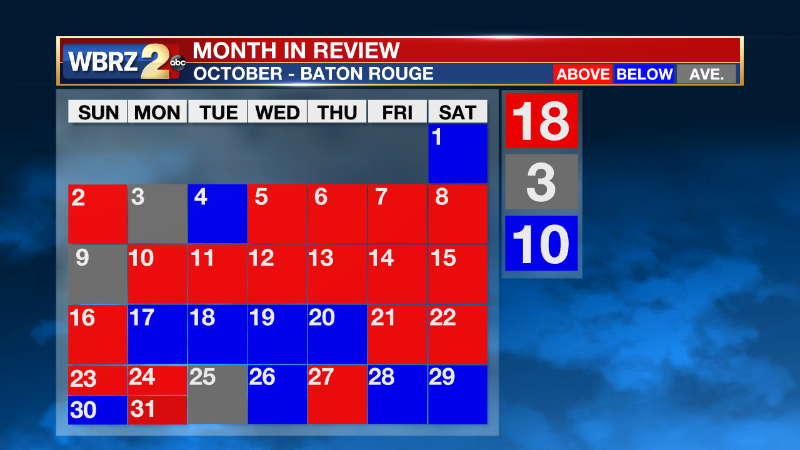
Although the month was abnormally dry, temperatures were just a tad on the warm side. We saw 18 days with above-average temperatures but no records were broken. The blast of colder air from Oct. 18-20 brought record-low temperatures for three consecutive days.

The forecast for this upcoming week is nothing out of the ordinary. The Storm Station is forecasting temperatures just above average, but nothing that will break any records. Rain will be light again this week. Our next rainmaker is set to move into the area on Saturday. Click here to see the 7-day forecast.


