

Latest Weather Blog
Sunday Evening Video Forecast
Related Story
The effects from this weekend’s frontal passage will have some staying power into next week. Parts of the area will continue to benefit from lower humidity for another day or two, before summer comes roaring back late in the week.
Tonight & Tomorrow: Skies will quickly fizzle during the evening, leaving mainly clear skies for the rest of the night. Lows will settle in the lower 70s in the Metro Area, with a few neighborhoods north of I-12 getting into the upper 60s. Expect a pleasant start to the day north of a frontal system stalling along the coast. Noticeably drier air will remain north of I-10. Southern communities may catch a break as well, though any northward drift of the front could bring a quick surge in humidity. Despite most benefiting from a humidity reduction, the summer heat will not let up. Look for a high in the mid-90s under a mostly sunny sky.
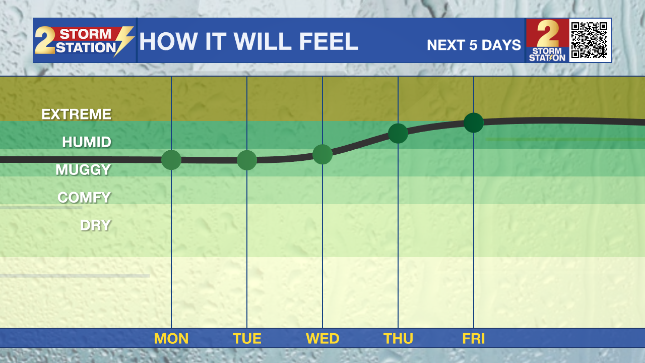
Up Next: Expect afternoon humidity to remain manageable through midweek, especially north of I-10/12. Nights, however, will trend on the muggier side. The relentless summer steam will fully return to the Capital Region by the end of the week. Daytime highs won’t budge, peaking in the mid-90s each afternoon. Rain will be tough to come by over the next few days. Even looking ahead into late week and the weekend, coverage stays sparse with spotty to isolated afternoon thunderstorms. For now, plan on keeping the sprinklers running.

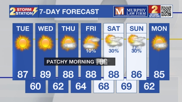
Get the latest 7-day forecast and real-time weather updates HERE.
Watch live news HERE.
The Tropics: The Gulf, Caribbean and Atlantic are quiet. No tropical development is expected over the next seven days.
— Meteorologist Malcolm Byron
The Storm Station is here for you, on every platform. Your weather updates can be found on News 2, wbrz.com, and the WBRZ WX App on your Apple or Android device. Follow WBRZ Weather on Facebook and X for even more weather updates while you are on the go.
News

