

Latest Weather Blog
Thursday PM Forecast: stormy stretch to follow hottest weekend so far this season
The Baton Rouge Area can gear up for the hottest weekend so far this summer as feel-like temperatures climb to near 105 degrees. Relief will arrive early next week, but a stalling weather system will swap the heat for heavy rain and an elevated risk of flooding.
Spiking Heat: feels-like temperatures 100-105 degrees this weekend
Stalling Front: rounds of thunderstorms early next week
Flood Risk: 3-6 inches plus over the wet stretch
Tonight & Tomorrow: A quiet and warm evening is ahead for the Capital Area. Under mostly clear skies, it will be warm and muggy with overnight lows in the low 70s. Friday will closely mimic recent weather, but you might notice a bit more stickiness in the air as tropical moisture begins a slow increase. Skies will be partly sunny with isolated, afternoon showers and thunderstorms—mostly confined to locations south of I-12.
.png)
Trending News
Up Next: Hot temperatures will hold their ground through the weekend. With humidity slowly creeping up as well, feels-like temperatures will go well over 100 degrees, even flirting with the criteria of 108 degrees that warrants a heat advisory. As afternoons heat up the landscape, typical coastal breezes will develop and trigger isolated showers and thunderstorms. Any that pop will fade away after sunset.
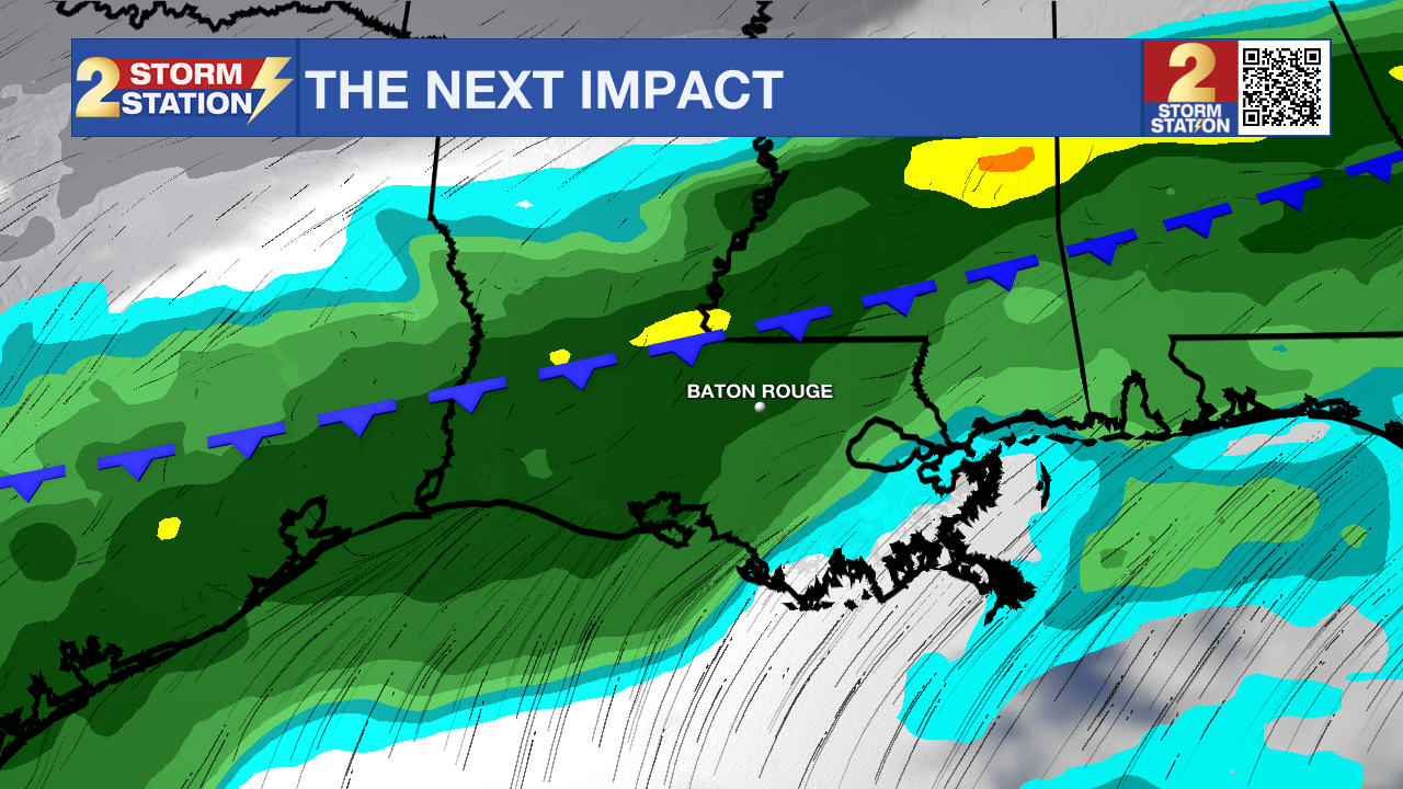
As the weekend comes to a close, the weather pattern will shift as a weak cold front moves into the Southeast. Ahead of this feature, deep tropical moisture will pool in the atmosphere and result in a round of stormy weather early next week. The incoming cold front will completely run out of steam on Monday, parking itself directly over northern Louisiana. This stalled boundary will act as a track for repeated rounds of heavy thunderstorms Monday through at least Wednesday. Because our soils have already absorbed over a foot of rain in the past month, a flash flooding situation could develop a little more easily than usual. Rain coverage will jump to 70% on Monday, peak at 90% on Tuesday, and hold at 60% on Wednesday. Over the three-day stretch, 3-6 inches of rain is expected, but small “bulls-eyes” of nearly double that will be possible. The National Weather Service has already issued a Level 2/4 “Slight Risk” of excessive rainfall for Monday.
Get the latest 7-day forecast and real-time weather updates HERE.
Watch live news HERE.
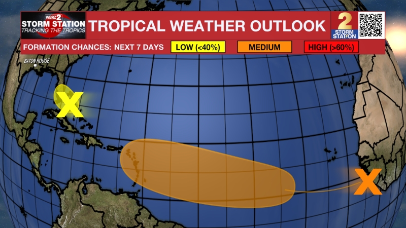
The Tropics: A tropical wave moving westward could create a broad area of low pressure over the Bay of Campeche late this week. However, conditions are unfavorable for significant development, and the system is expected to move inland over eastern Mexico by late this weekend.
– Josh
The Storm Station is here for you, on every platform. Your weather updates can be found on News 2, wbrz.com, and the WBRZ WX App on your Apple or Android device. Follow WBRZ Weather on Facebook and X for even more weather updates while you are on the go.
More News
