

Latest Weather Blog
Friday PM Forecast: Extreme Heat Warning issued as unrelenting heat takes hold
Intense late-summer heat will grip the Capital Area through the weekend and well into next week. With temperatures consistently reaching the upper 90s and heat index values pushing past 110°, expect near-daily heat alerts.
An Extreme Heat Warning will be in effect across all of southeast Louisiana and southern Mississippi from 11 a.m. to 8 p.m. Saturday. An Extreme Heat Watch has been preemptively issued for Sunday and is expected to be upgraded later. Those spending time outside over the weekend, including folks helping with move-in to LSU, will need to take frequent shaded breaks, drink plenty of water, and stay alert for signs of heat exhaustion.
It’s important to remember that heat stacks up over time, with a cumulative impact on the body with each day. As this stretch of heat continues, check in with friends, neighbors, and family — especially young kids, the elderly, and anyone without access to A/C.
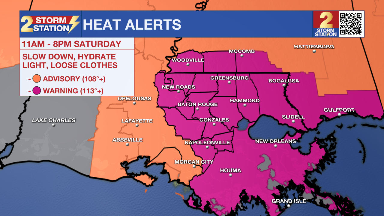
Tonight & Tomorrow: Weather won’t be an issue for Friday night plans, as long as the warm and sticky feel isn’t too bothersome. Temperatures will drop through the 80s during the evening, bottoming out in the mid-70s by daybreak. Abundant sunshine will drive temperatures in the upper 90s once again on Saturday. Factor in the humidity, and the heat index will likely peak near 110°. Rain won’t provide much heat relief, as shower activity will be minimal.
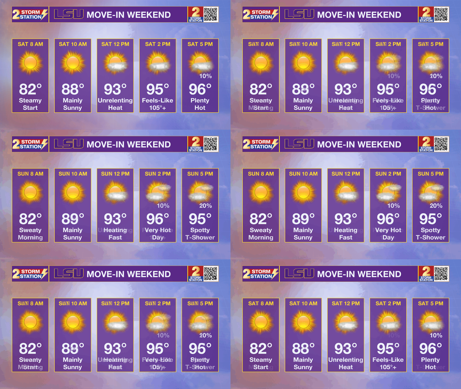
Up Next: With upper-90s sticking around throughout much of next week, heat impacts will stack up as high heat and humidity take a cumulative toll on the body. Despite highs hovering near 97°, higher humidity will drive the heat index, or feels-like temperature, upwards of 110° during peak heating. Nights will offer little relief also, with overnight lows settling in the mid-to-upper-70s.
Trending News
Moisture increases slightly Sunday into next week, bringing a chance for spotty afternoon storms. Still, activity will be hit-or-miss, with no major rain totals expected. With more than an inch and a half of moisture coming out of the soil over the next week, the lack of replenishing rain will keep grass crunchy. The ongoing hot, dry pattern could trigger a flash drought within a few weeks.

The Tropics: A tropical wave located 350 miles east of the Windward Islands is producing a large area of showers and thunderstorms. At one point, this wave had a high chance of development, but it has not been able to organize sufficiently in recent days. Now moving into a region of dry air with strong wind shear, tropical development appears highly unlikely.
There is another tropical wave over the central tropical Atlantic trailing behind. While environmental conditions are conducive for some development over the next few days, the system will also meet a similar fate of encountering strong wind shear next week. There is now a low chance of development with this wave, too.

Get the latest 7-day forecast and real-time weather updates HERE.
Watch live news HERE.
— Meteorologist Malcolm Byron
The Storm Station is here for you, on every platform. Your weather updates can be found on News 2, wbrz.com, and the WBRZ WX App on your Apple or Android device. Follow WBRZ Weather on Facebook and X for even more weather updates while you are on the go.
More News

