

Latest Weather Blog
Friday AM forecast: Hot, Humid With More Afternoon Storms
Heat and humidity will continue Friday, with afternoon temperatures reaching the low to mid 90s. Scattered thunderstorms will provide some relief in spots, but the heat and storm chances will continue into the weekend.

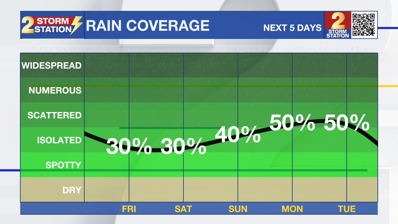
Today and Tonight: Friday will be another hot and humid summer day, with highs generally in the low to mid 90s and heat index values around 105 degrees. Isolated to scattered showers and thunderstorms will develop during the afternoon, with the best coverage coming during the peak heating hours.

Use the slider to advance through the next 24 hours of Futurecast
Most locations will not see rain, but any storm that develops could produce frequent lightning, brief heavy downpours and gusty winds. Storms will be slow-moving Friday, so a few spots could pick up 2 to 3 inches of rain in a short period of time, although widespread heavy rain is not expected.
Trending News
Up Next: Storm chances increase this weekend as more Gulf moisture moves into the region. Rain chances rise to around 40–60% Sunday and Monday, with more scattered to numerous afternoon storms expected. Storms should move a little faster Sunday and Monday, which will help limit the overall heavy rain threat. Still, some locations could see 1–2 inches of rain in a short time, especially where stronger storms develop. Temperatures remain in the low to mid 90s, with heat indices around 105 degrees.
Tropics: The tropics remain quiet. The National Hurricane Center says tropical cyclone development is not expected anywhere across the Atlantic Basin during the next seven days.
Get the latest 7-day forecast and real-time weather updates HERE.
Watch live news HERE.
– Dave
The Storm Station is here for you, on every platform. Your weather updates can be found on News 2, wbrz.com, and the WBRZ WX App on your Apple or Android device. Follow WBRZ Weather on Facebook and X for even more weather updates while you are on the go.
More News

