

Latest Weather Blog
Dry Air Setting up Camp
THE FORECAST:
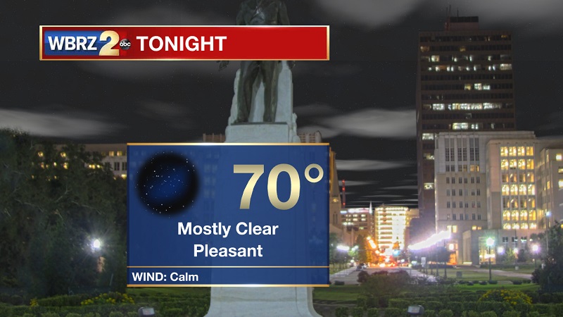
Tonight and Tomorrow: A nice night ahead, as mostly clear skies stay overhead. Winds will stay calm through the night, as temperatures drop into the 70s around 9 PM before reaching an overnight low of 70°. Sunny and warm conditions continue for Monday, with highs peaking near 91° with heat index values around 96°.
Up Next: Dry and sunny conditions persist through the week, as above average high temperatures stay the course. Next batch of showers possible late in the week.
Trending News
The Tropics:
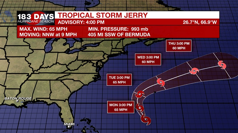
Tropical Storm Jerry is currently located about 405 miles south-southwest of Bermuda with 65 mph sustained winds and moving north-northwest at 9 mph. A turn toward the north is expected on Monday, followed by a turn toward the north-northeast on Tuesday, and toward the northeast on Wednesday. On the forecast track, the center of Jerry is expected to pass near Bermuda Tuesday night. Little change in strength is forecast during the next 48 hours.
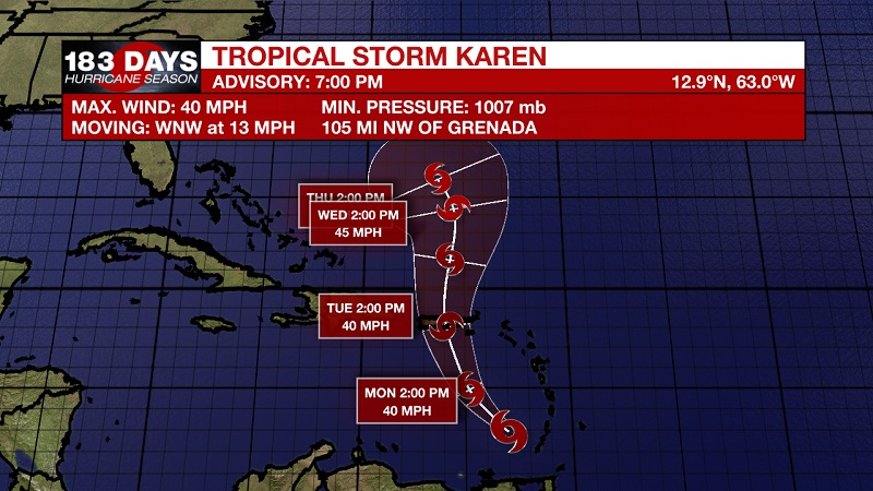
Tropical Storm Karen is currently located about 105 miles northwest of Grenada and about 350 miles south-southeast of St. Croix with 40 mph sustained winds and moving west-northwest at 13 mph. A turn toward the northwest is forecast to occur later tonight or on Monday, followed by a turn toward the north on Tuesday. On the forecast track, the center of Karen will continue to move away from the Windward Islands this evening, and then move across the eastern Caribbean Sea tonight and Monday. On Tuesday, Karen is expected to pass near or over Puerto Rico and the Virgin Islands. Little change is strength is forecast during the next 48 hours.
Tropical Storm Warning
*Grenada
*St. Vincent
Tropical Storm Watch
*US Virgin Islands
*Puerto Rico
*British Virgin Islands
Satellite imagery indicates that a broad area of low pressure has formed in association with a strong tropical wave over the far eastern Atlantic. The associated thunderstorm activity continues to show signs of organization, and a tropical depression or tropical storm is expected to form later today or tonight while the system moves generally westward over the eastern tropical Atlantic at 15 to 20 mph. The National Hurricane center is forecasting a 90% chance of tropical development within the next 2 days, which increases to a 90% chance within the next 5 days. 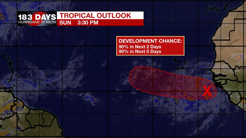
THE EXPLANATION:
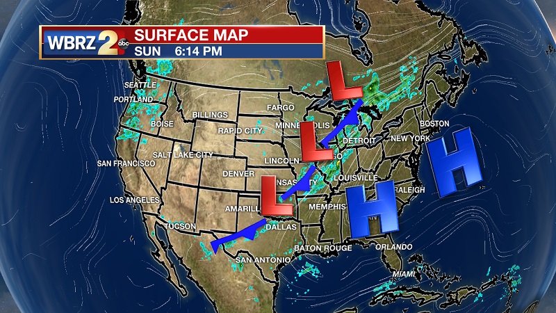
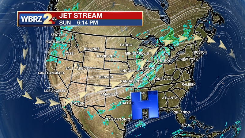
All hail the all-powerful ridge! This strong upper level ridge is over the entire southeast US and extends into Texas. Surface high pressure is also centered over North and South Carolina through the northern Gulf. This high pressure through all levels will keep skies sunny and conditions dry. Temperatures will stay above average, but the silver lining will be the lower dewpoints due to the dry air that has set up camp over our area. There is a chance that the ridge slides east late in the week, allowing for spotty to isolated afternoon showers Friday. This ridge could stay suppressed through the weekend, potentially keeping showers in the forecast. If this forecast stays, September may end up being the hottest and driest on record.
--Meteorologist Matt Callihan
The WBRZ Weather Team is here for you, on every platform. Your weather updates can be found on News 2, and the WBRZ WX App. on Apple and Android devices. Follow WBRZ Weather on Facebook and Twitter for even more weather updates while you are on the go.
More News
