

Latest Weather Blog
UPDATE: Severe weather marches east, lingering showers/storms
10 a.m. Update: After an incredibly active morning, the strongest storms now appear to be pushing east. Light to moderate rain will continue for the next several hours. Even some pockets of heavier rain are possible closer to Ascension and St. James parishes. That is where we find a heightened flash flooding risk.
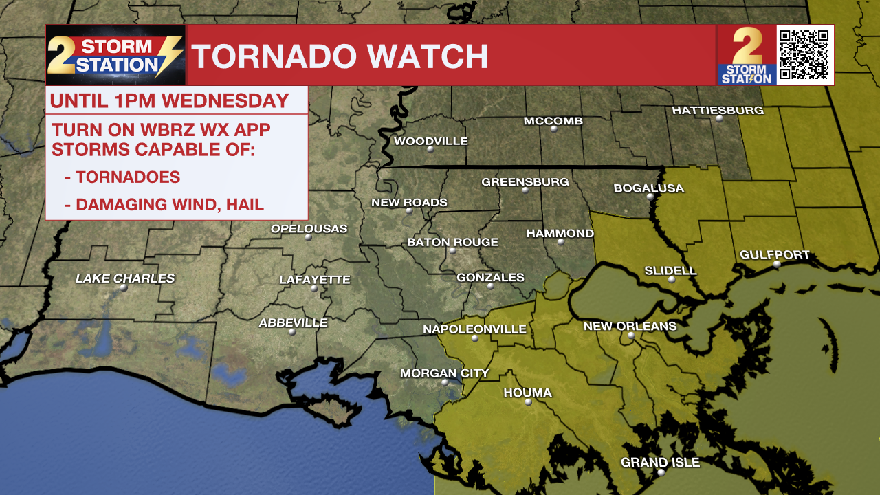
10am Wednesday - It's been quite an active morning! As evidenced by where warnings are located, the strongest storms now sit to the east of Baton Rouge. The severe threat is beginning to wind down across the capital area.
— WBRZ Weather (@WBRZweather) April 10, 2024
Please send your photos/video to weather@wbrz.com pic.twitter.com/mUqTkxsc4i
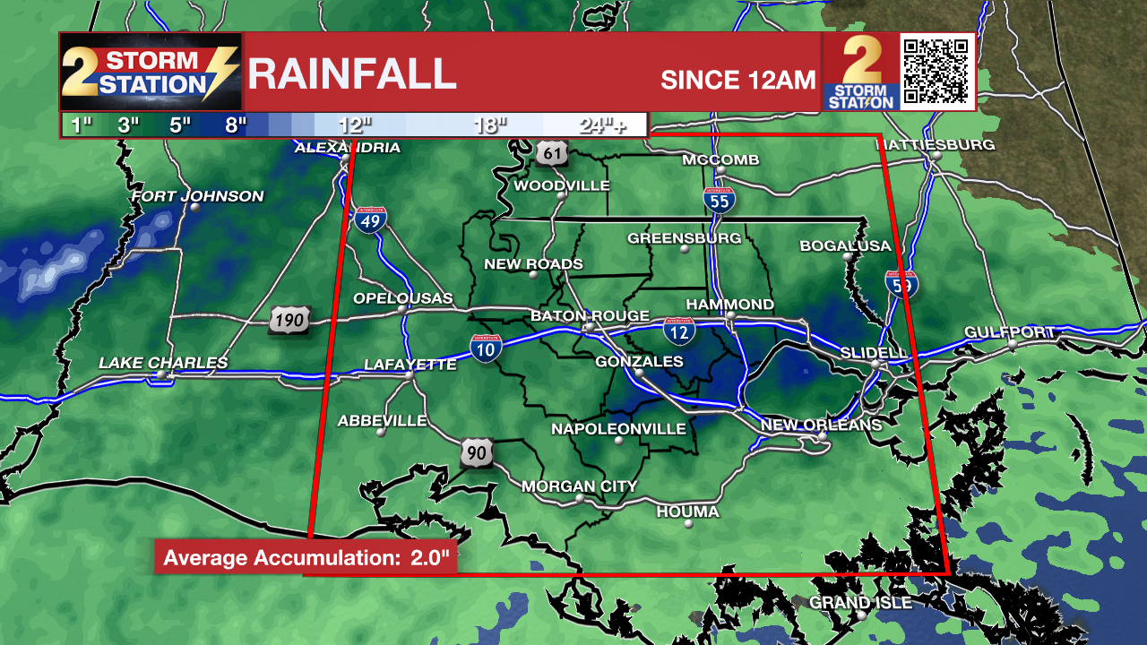
As the severe weather threat diminishes, isolated standing water concerns remain. Several inches of rain have fallen across the Storm Station forecast area.
A Tornado Watch been remains in effect for the capital area and points east until 1 p.m. Wednesday. But since the threat appears to be winding down, there's a chance some parishes will be removed from the Watch early.
Trending News
Today: Clouds, shower and thunderstorms may be ongoing as early as daybreak. Regardless of thunderstorms, all will experience gusty south winds, sustained at 15-25mph but in excess of 35mph, at times. It will be rather muggy and high temperatures will warm into the upper 70s. Both will help to fuel thunderstorms.
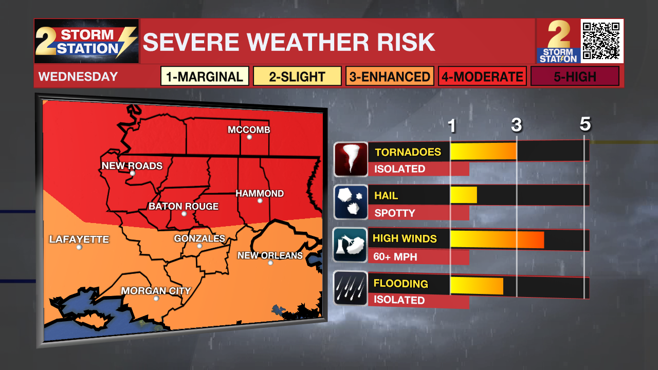
There is a level 4/5 "Moderate Risk" for severe weather. This means numerous severe thunderstorms are expected within the level 4 shaded area. Not everyone within that risk area will experience severe weather.
A significant weather threat may develop by Wednesday morning. At this time, most of the important ingredients for severe thunderstorms look as though they will come together right over the I-10/12 corridor and points to the north. The timeline for the most active weather will be during the first half of the day, from approximately sunrise through early afternoon. The main threats appear to be damaging wind gusts, tornadoes and heavy rain. Review plans for severe weather HERE and stay with the Storm Station for continuing updates. Make sure you have a way to receive forecasts and alerts such as the free Storm Station Weather App, which you can download HERE.
 |
 |
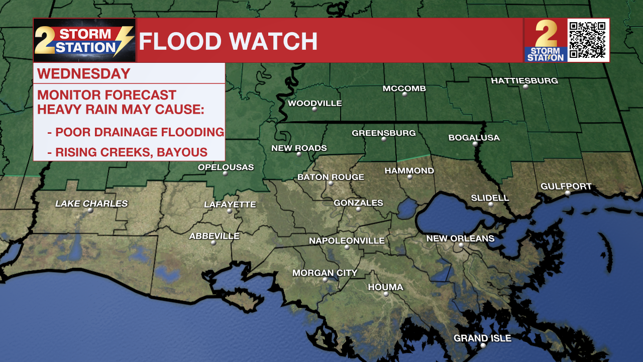
(Left) A flood watch has been issued for SW Mississippi and neighboring parishes during the day on Wednesday. Torrential rain rates in thunderstorms could result in a quick 2-4"+ of rain and therefore flooding of low lying and poor drainage areas.
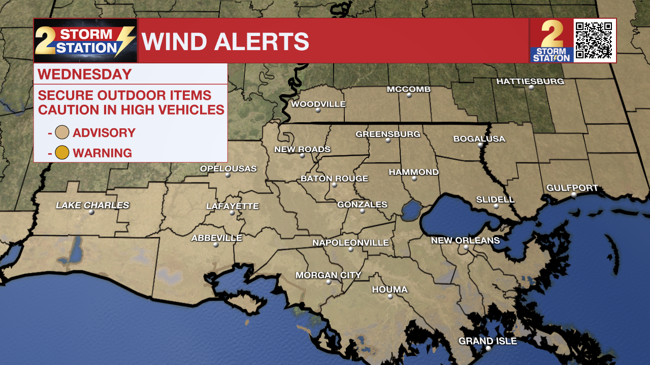
(Right) A wind advisory has been issued for SE Louisiana and SW Mississippi during the day on Wednesday. Gusty winds could knock down power lines, trees, etc. as wind gusts up to 40 mph+ are possible outside of storms. Make sure to secure any outdoor furniture or items that could easily blow away.
The storm system will move fast and some clearing is even possible by late Wednesday. The rest of the workweek will be tranquil with mainly clear skies, lows in the mid 50s and highs in the upper 70s. Some high clouds will start to mix in over the weekend, but will not produce any rain. The mornings will start off seasonable in the mid 50s followed by warm afternoons in the low 80s.
Get the latest 7-day forecast and real time weather updates HERE.
Watch live news HERE.
The Storm Station is here for you, on every platform. Your weather updates can be found on News 2, wbrz.com, and the WBRZ WX App on your Apple or Android device. Follow WBRZ Weather on Facebook and Twitter for even more weather updates while you are on the go.
More News
