

Latest Weather Blog
Wednesday PM Forecast: Grabbing the coats following a strong Thursday cold front
A sharp cold front will bring a noticeable chill for the rest of the week. Keep the jackets and even heavier coats handy by the weekend, when a few spots might even wake up to frost. Rain chances also return eventually, with another round of light showers possible toward next week.
Tonight & Tomorrow: One more relatively mild night is in store for the Capital Area, with lows settling in the mid-to-upper 50s across the region. A few spots south of I-10 may even hold closer to 60°. At the same time, a strong cold front will push into the region toward dawn. A few high clouds will linger overnight, but they’ll quickly clear toward the coast as the front sweeps offshore. Colder air will lag behind the front somewhat, so expect another seasonably warm afternoon on Thursday with highs in the mid-to-upper 70s under mainly sunny skies. Then, the real chill arrives with falling temperatures late in the day.
Up Next: Friday will begin noticeably cooler in the mid-70s, barely warming into the low 70s by afternoon. Very dry air and increasing north winds will bring an elevated fire danger, especially with already bone-dry grass, brush, and plants. If under a local burn ban, continue to avoid all outdoor burning. Additionally, properly dispose of cigarettes and avoid hot vehicles over dry grass.
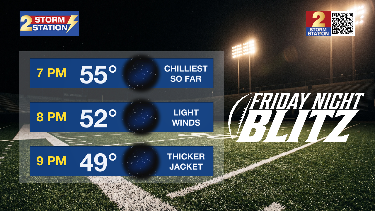
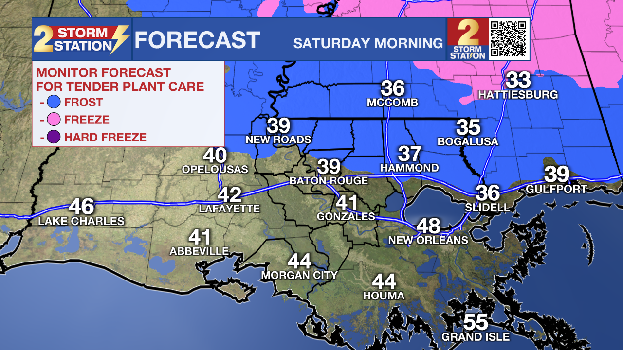
The coldest point after the cold front will come Friday night. High school football will kick off on a chilly note with temperatures in the mid-50s, falling into the 40s by final whistle. On Saturday morning, lows could plunge into the upper 30s for the first time since March near and northeast of Baton Rouge. Especially in lower-lying areas north of I-12, the risk of patchy frost will go up. Tender plants might struggle in such conditions, so consider covering up these plants temporarily. The chill will remain into Saturday, with extra layers a must for game day festivities in the Capital City.
Clouds will float back into the area Sunday into Monday alongside a weak coastal storm system. Light showers may accompany the cloud cover, picking up late Sunday and carrying over into Monday. Details remain uncertain regarding the exact outcome, so continue to monitor the forecast for updates as the weekend approaches. Meanwhile, mornings will stay chilly in the 40s into next week, with comfortable afternoons in the 60s and 70s.
Trending News

Get the latest 7-day forecast and real-time weather updates HERE.
Watch live news HERE.
The Tropics: The Gulf, Caribbean, and Atlantic are all quiet. No development is expected over the next seven days as the end of hurricane season nears.
— Meteorologist Malcolm Byron
The Storm Station is here for you, on every platform. Your weather updates can be found on News 2, wbrz.com, and the WBRZ WX App on your Apple or Android device. Follow WBRZ Weather on Facebook and X for even more weather updates while you are on the go.
More News

