

Latest Weather Blog
Saturday AM forecast: Two Games! One Great Forecast!
Noticeably pleasant weather across South Louisiana, with cooler temperatures and much lower humidity expected through the start of next week. The dry conditions will also increase fire weather concerns, especially Sunday through Tuesday, as drought conditions continue.

Today and tonight: Cooler and drier air will continue moving into the area today. Expect a mix of sunshine and some high clouds, with afternoon temperatures topping out in the 70s. Humidity will gradually drop through this afternoon. Tonight will be cooler, with lows dropping into the 40s for most locations. Skies should remain mostly clear.
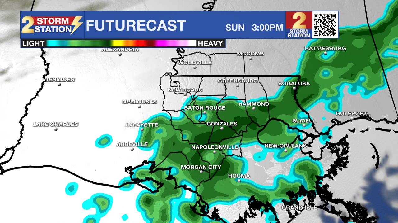
Use the slider to advance through the next 24 hours of Futurecast
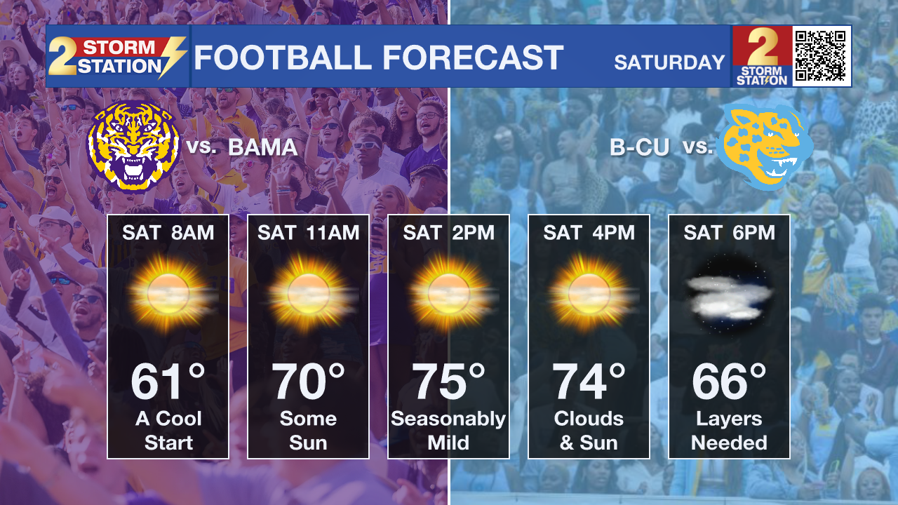
Football Forecast: It's going to feel like fall this afternoon as Southern hosts Bethune-Cookman at 2 PM and LSU welcomes Alabama to Tiger Stadium at 2:30 PM. Kickoff temperatures will be in the mid-70s, with a mix of sunshine and some high clouds. A light breeze will keep things comfortable. Temperatures will fall through the lower 70s and into the upper 60s by the fourth quarter. It'll get cooler after sunset, so bring a light jacket for the walk back to the car.
Trending News
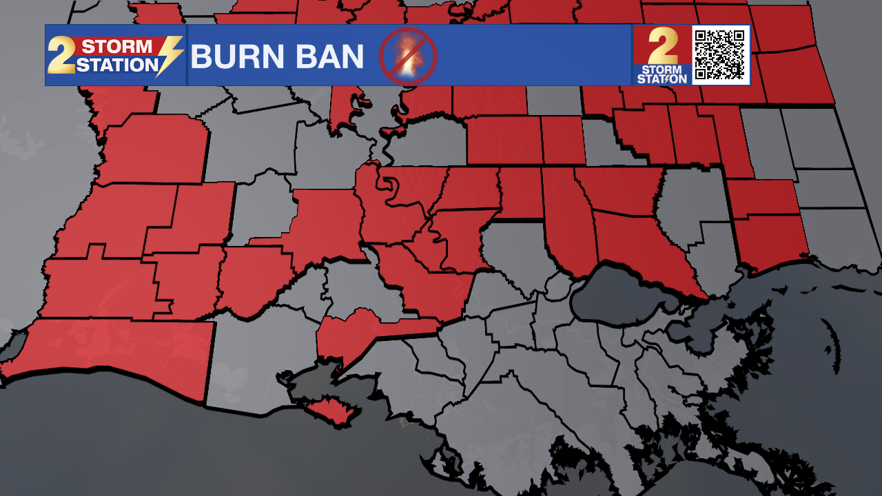
Up Next: The cooler, drier pattern continues Sunday and Monday. Afternoon highs will remain in the 70s, while morning lows settle into the 40s. Humidity will be exceptionally low for this time of year. That combination of dry air and ongoing drought conditions will elevate fire weather concerns Sunday through Tuesday. Anyone in an area under a burn ban should avoid outdoor burning.
A weak disturbance could bring a few sprinkles Tuesday afternoon, but meaningful rainfall is not expected at this time. Forecast confidence decreases a bit Tuesday night into Wednesday, when another disturbance and cold front move through the region. Rain chances remain uncertain, and any rainfall that develops currently looks limited.
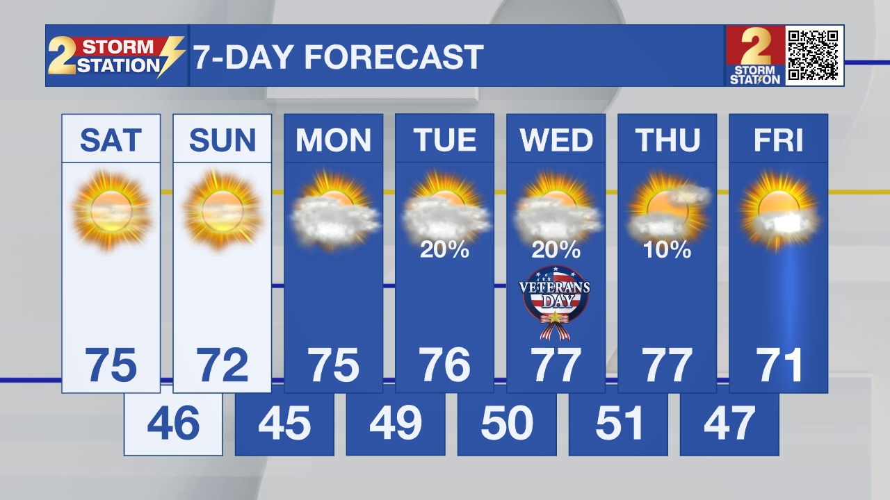
Mid-week temps will be warm, but much cooler air is expected with Friday’s highs potentially staying below 70 degrees. Some locations could even see temperatures dip into the 30s Friday night, although that is still several days away.
Tropics: The National Hurricane Center is monitoring a non-tropical low in the western and central Atlantic, several hundred miles southeast of Bermuda. The system could briefly acquire some subtropical characteristics through tonight, but its chances of tropical or subtropical development remain low at 10% over the next 48 hours and seven days.
-Dave
Get the latest 7-day forecast and real-time weather updates HERE.
Watch live news HERE.
The Storm Station is here for you, on every platform. Your weather updates can be found on News 2, wbrz.com, and the WBRZ WX App on your Apple or Android device. Follow WBRZ Weather on Facebook and X for even more weather updates while you are on the go.
More News

