

Latest Weather Blog
Saturday AM forecast: Storms Could Impact LSU Game Day
A potentially wet Saturday is ahead across South Louisiana. Storms will become increasingly likely later this afternoon, bringing a heavy rain threat before rain chances drop off and hotter weather returns Sunday.

Today and Tonight: After a sunny start, showers and thunderstorms will begin popping up by late morning and become more numerous through the afternoon. With plenty of moisture in place, some storms could produce heavy rainfall rates. Storms will move slowly enough for repeated downpours to cause minor street flooding, especially in low-lying and poorly drained urban areas. South Louisiana remains under a marginal, Level 1 of 5, flood risk today.

Use the slider to advance through the next 24 hours of Futurecast
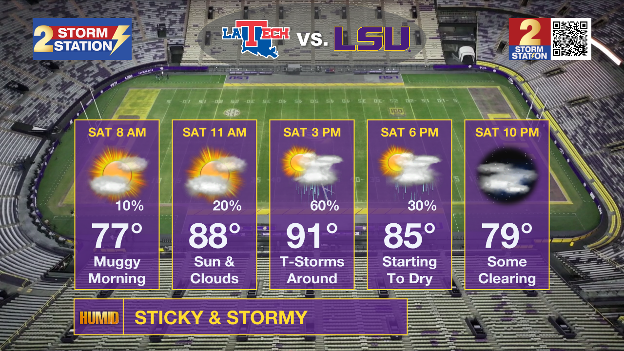
LSU Game Day: If you're heading to LSU for tailgating this afternoon, plan for a good chance of showers and thunderstorms developing through the afternoon. Heavy rain, lightning and brief gusty winds could interrupt tailgating, so keep an eye on the radar and have a place to get inside if storms approach. The LSU game kicks off at 6:30 p.m. Storm coverage should be decreasing by then, but a few showers or storms could still linger into the early evening.
Trending News
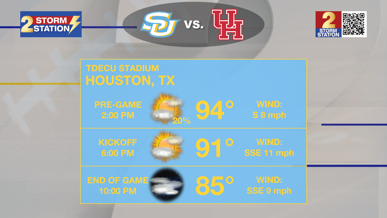
Southern Football on the road: In Houston, the Southern Jags will play this evening at 6pm. Travelers should be fine outside of a stray shower. Chances for rain in Houston will be considerably lower. But expect temperatures in the 90s during tailgating, and still near 90 degrees for kickoff.
Up Next: The weather pattern changes quickly Sunday as a ridge builds in from the west. Rain chances will be dropping, with most storms favoring the sea-breeze and lake-breeze boundaries.
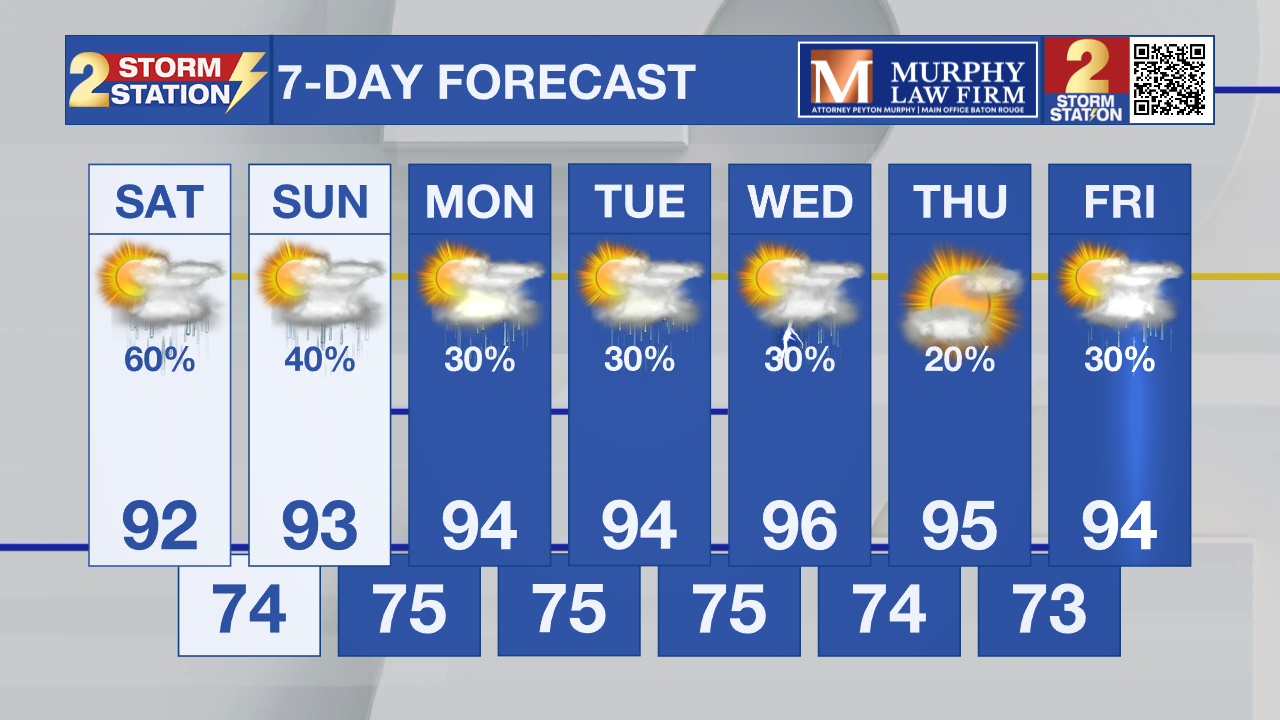
Temperatures climb back into the lower 90s Sunday and Monday. While storms will be less numerous, the strongest ones could produce gusty winds. By Tuesday, the ridge strengthens further, and storm coverage drops even more. Much hotter and relatively drier weather is expected through much of next week, with highs in the low to mid 90s.

Tropics: The National Hurricane Center does not expect any tropical cyclone formation in the Gulf, Caribbean Sea, or Atlantic during the next seven days.
– Dave
Get the latest 7-day forecast and real-time weather updates HERE.
Watch live news HERE.
The Storm Station is here for you, on every platform. Your weather updates can be found on News 2, wbrz.com, and the WBRZ WX App on your Apple or Android device. Follow WBRZ Weather on Facebook and X for even more weather updates while you are on the go.
More News

