

Latest Weather Blog
Monday AM Forecast: Quiet Today, Watching Mid-Week Storm Potential
A few showers may develop, but most of the region should stay relatively quiet. Rain chances increase Tuesday as a cold front approaches, bringing the possibility of a few strong storms Tuesday night into early Wednesday.

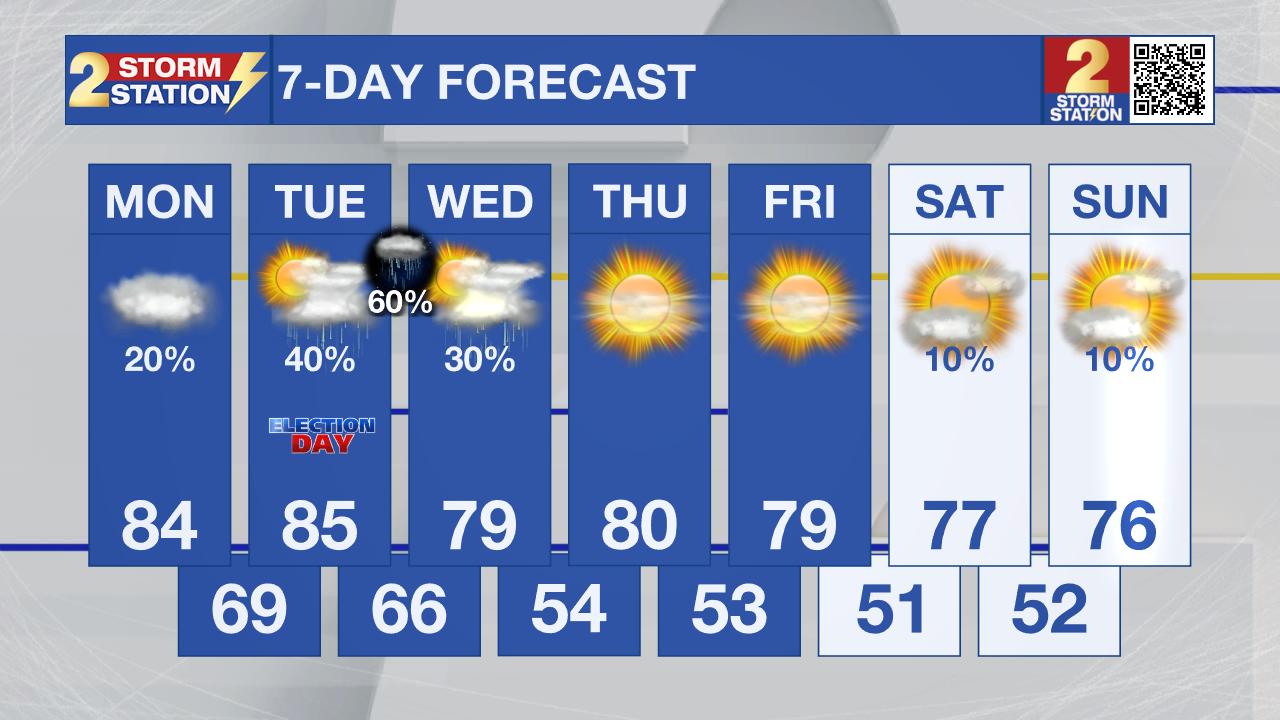
Today and tonight: Expect mostly cloudy skies this morning, with some gradual improvement as the day goes on. A few isolated to scattered showers could develop, but coverage should remain limited. High temperatures will reach the low to mid 80s, with overnight lows near 70.
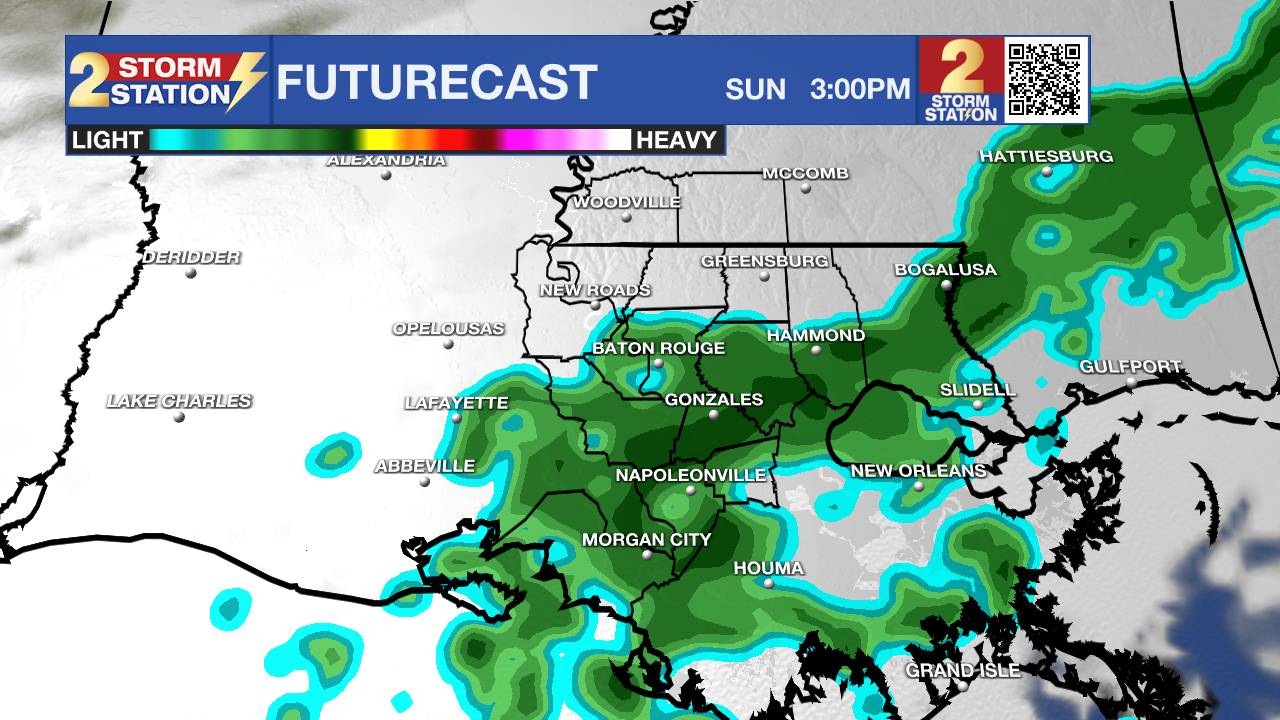
Use the slider to advance through the next 24 hours of Futurecast
Up Next: Our attention turns to Tuesday as a stronger system approaches the region. Showers could begin developing across the northwestern portions of the area by Tuesday afternoon, with additional thunderstorms possible Tuesday night into early Wednesday as a cold front moves through.
Trending News
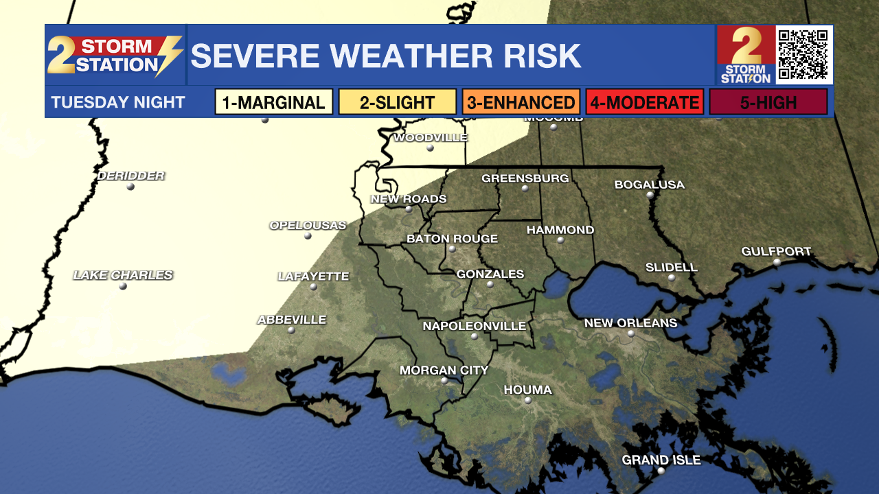
The latest forecast guidance has pushed the stronger part of this system northward, and the overall severe weather threat now appears relatively low. A few stronger storms remain possible, mainly near the northwestern portions of the region, where isolated damaging wind gusts would be the primary concern. Rainfall totals also look less impressive, with most locations expected to receive less than a half inch. Showers may linger Wednesday morning, then quickly move east. The rest of the workweek looks mostly dry, with highs in the upper 70s and cooler nights.
Tropics: The National Hurricane Center does not expect tropical cyclone formation in the Atlantic basin during the next seven days.
-Dave
Get the latest 7-day forecast and real-time weather updates HERE.
Watch live news HERE.
The Storm Station is here for you, on every platform. Your weather updates can be found on News 2, wbrz.com, and the WBRZ WX App on your Apple or Android device. Follow WBRZ Weather on Facebook and X for even more weather updates while you are on the go.
More News

