

Latest Weather Blog
Thursday PM Forecast: next rain before the weekend is out
As the workweek ends and weekend begins, quiet weather will continue. Rain will make a return on Sunday though.
Tonight & Tomorrow: Clear skies and light, north winds will bring the chilliest night of the 7-Day Forecast. Low temperatures will be near 40 degrees on Friday with some readings in the upper 30s possible north and east of Baton Rouge. Ample sunshine will persist on Friday as winds take on an easterly direction. High temperatures will make it back into the upper 60s with one or two spots possible hitting 70 degrees.
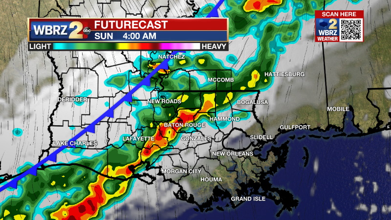
Up Next: The first half of the weekend will start in fine shape with sunshine and high temperatures crossing into the low 70s. Enjoy some outdoor time then because Sunday looks more gloomy. A weak cold front will settle into the area with clouds and showers. Fortunately, this system looks rather meager and will not bring any threat for severe weather or heavy rain. The front could stall in the northern Gulf of Mexico though and cause some dreary weather to hang on south of I-12 into early next week. Temperatures will only trail off a few degrees behind the front, generally keeping close to seasonable averages in the 60s and 40s.
Get the latest 7-day forecast and real time weather updates HERE.
Trending News
Watch live news HERE.
Detailed Forecast: As a surface high pressure settles over the Mid-South, light northwest winds over the local area will continue cooler and drier air advancing into the region overnight. The high will be overhead Friday leading to a calm and seasonable day. By Saturday, the high will move far enough east for some weak onshore flow to resume. On Sunday, a front will crawl into the Mid-Mississippi River Valley as a parent upper level trough of low pressure digs into the Lower Midwest providing the front a push toward the Gulf Coast. With return flow only on for about a day, moisture will be somewhat limited and that will keep showers lighter and scattered as the front moves through. As the front slows and upper level winds start to parallel the boundary in the norther Gulf, some clouds and moisture could linger, especially for the coastal areas, on Monday and possible Tuesday. Like the front earlier this week, that next one will not deliver a major change in temperatures either, rather keep readings close to average.
--Josh
The Storm Station is here for you, on every platform. Your weather updates can be found on News 2, wbrz.com, and the WBRZ WX App on your Apple or Android device. Follow WBRZ Weather on Facebook and Twitter for even more weather updates while you are on the go.
More News
