

Latest Weather Blog
Showers Tuesday, severe storms possible Wednesday
As temperatures warm, so too will instability and the threat for strong thunderstorms—especially Wednesday.
THE FORECAST:
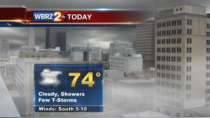
Today and Tonight: Tuesday will show mostly cloudy skies and bring scattered showers and thunderstorms to the region. Temperatures will remain sticky with highs in the low 70s. Overnight, more shower activity will be accompanied by lows in the mid 60s.
Trending News
Up Next: For Wednesday, the Storm Prediction Center has placed the area under a “slight risk” for severe weather. This means that there is a 15% chance of a severe thunderstorm within 25 miles of any given point—much higher than on a typical day. Thunderstorms will feed off of an unseasonably warm and humid environment thus during the middle of the day, with peak heating, a couple of storms could cause damaging wind gusts and a few tornadoes. Visit Meteorologist Josh Eachus on Facebook for a detailed video briefing and answers to your questions about the severe weather potential. As far as temperatures go, it will be warm and muggy. Expect highs in the upper 70s and lows in the upper 60s. Christmas Eve and Christmas Day will continue to find a few showers and warmer temperatures. In fact, Christmas Day could be close to the warmest on record. That mark is from 1942 at 82° and right now we’re projecting 80°.
THE SCIENCE:
Forecast Discussion: A strong 250mb jet continues a southwesterly sweep across the region. With this occurring, ripples of energy in the flow beneath will continue to produce batches of rain and thunderstorms. On Wednesday, a more significant 500mb trough moving from the Midwest to Great Lakes will help to fire off a round that could create some issues for parts of the Mississippi River Valley. At the surface, while no low pressure center or front will be present locally, forecast models continue show increased instability in the warm sector of a surface system racing out of the Midwest into the Great Lakes region. CAPE values exceeding 1,500 j/kg seem plausible with high temperatures getting into the upper 70s. Solar insolation during the afternoon hours will only add to this—making it the primary timeframe to watch. Dew points will be high and the atmosphere will be sufficiently moist. A strong lower level jet stream beneath an even stronger upper jet will create deep shear and certainly support supercells in theory. So, several ingredients seem to be in favor of severe thunderstorms. Therefore, in line with CIPS analog guidance, the Storm Prediction Center has hashed out a “slight risk” area from the Gulf Coast into Mississippi and then an “enhanced risk” north of that. At this time, it appears as though clusters of showers and thunderstorms would be capable of damaging wind gusts and a few tornadoes. The jet stream will relax somewhat by the end of the week, but a persisting trough-west, ridge-east pattern will continue to leave showers in the mention for Christmas Eve and Christmas Day, though some sunshine may well peek out as well. As far as temperatures go, don’t expect to see a cold front kick through the area and end unseasonable warmth until at least Sunday.
--Josh
Stay connected with me… share your thoughts!
Twitter: @Josh_Eachus
Google+: Josh Eachus
Facebook: Meteorologist Josh Eachus
More News
