

Latest Weather Blog
Showers possible for the late commute, cooler tomorrow
After a front moves through the area today, a stretch of below normal temperatures is on the way.
THE FORECAST:
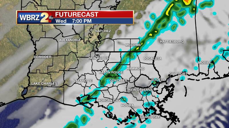
Today through Tomorrow: A cold front will enter the region on Wednesday. With this system, passing clouds and a few showers are anticipated but rain will not be significant. In fact, some locations may not even receive any. Those that do shouldn’t see much more than a quarter of an inch in the gauges. The most likely time for showers will be between 4-7pm. A rumble of thunder isn’t out of the question. Prior to the front, mostly cloudy skies are expected with temperatures in the mid 70s. As skies clear, cooler air will begin to arrive overnight into with lows back in the upper 40s.
Up Next: Chilly air, about 5 degrees below average, will prevail through the weekend. Highs are forecast to be near 59 degrees, with lows near 40 degrees. Completely to mostly clear skies are anticipated Thursday through Sunday and no additional rain is on the board until at least the middle of next week.
Trending News
THE SCIENCE: A zonal flow will be disturbed by a weak trough moving through the upper levels on Wednesday. An associated cold front will move into the area. Moisture recovery in the area has been fairly subtle and only in the lowest levels. Therefore, with little dynamic support, uplift along the boundary will only produce a patch of clouds and narrow or broken band of showers around Midday. Thanks to typical southerly surface wind ahead of the front, highs will again make it to the 7-0s before the front crosses. A cooler air mass will settle into the region by Thursday with strong surface high pressure setting up in the Western United States. A period of calm weather is then expected through the weekend as a result. Northerly winds will maintain cool air right through Friday. An upper trough will deepen and dig into the Southeastern United States Saturday through Monday and expect temperatures to respond by dipping just a few degrees cooler each day as a result. While no freezing temperatures are expected, lows could be in the mid 30s by Monday Morning.
--Josh
More News
