

Latest Weather Blog
Several rain chances this week, no washouts expected
Several fast moving but weak disturbances will cross the area this week. While no days look to be a washout, many will carry a chance for showers.
THE FORECAST:
Today and Tonight: A weak cold front moving through Louisiana and Mississippi will create increasing clouds through the afternoon hours with isolated showers possible during the afternoon and evening hours. High temperatures will top out in the mid to upper 60s prior to the frontal passage. Overnight, thermometers will drop into the low 50s as skies clear out behind the boundary.
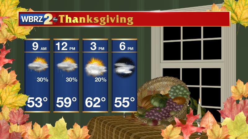
Up Next: Rain chances will diminish by Tuesday morning, with some sunshine returning for the afternoon. Behind the weak cold front, temperatures will be a few degrees cooler. The next few weather makers are nondescript and these weaker systems can be a little trickier to forecast. At this time, it appears that travel day (Wednesday) should be clear locally and around much of the country with exceptions in the Great Lakes and Pacific Northwest regions. The next disturbance will then arrive Wednesday night into Thanksgiving morning with some passing showers, especially south of the I-10 corridor. Temperatures will generally remain at or below average with highs in the low to mid 60s and lows in the 40s.
Trending News
The Tropics: With just under two weeks left in the official hurricane season, all is quiet. No development is expected in the Gulf of Mexico, Caribbean Sea or Atlantic Ocean.
THE EXPLANATION:
A weak cold front will move through the Southeastern U.S. through Monday. The associated upper level wave will continue to weaken as it moves through. Because of the recent cool, dry weather it will likely take most of the day for the atmosphere to moisten up enough for measurable rain to develop. Rain chances will increase into the afternoon and evening hours but still only expect isolated to perhaps scattered activity to form in the 13 Parish, 3 County forecast area. As the cold front passes overnight, drying will occur from west to east. Thermometers will be a few degrees cooler on Tuesday behind the front but more sun is anticipated. The forecast is difficult beyond the first two days of the week. The fast moving jet stream will send several weak disturbances through the region and model guidance is not handling the scenario well. The next system to affect the area will likely be Wednesday night into Thanksgiving with passing showers, mainly south of I-10. Yet another wave will come by on Friday and looks like a better chance for area wide rain and possibly some thunderstorms too.
--Dr. Josh
The WBRZ Weather Team is here for you, on every platform. Your weather updates can be found on News 2, wbrz.com, and the WBRZ WX App. on Apple and Android devices. Follow WBRZ Weather on Facebook and Twitter for even more weather updates while you are on the go.
More News
