

Latest Weather Blog
Monday PM Forecast: layers needed for outdoor Mardi Gras plans
Quiet weather is in store for the week ahead. Expect a very gradual warming trend.
Next 24 Hours: Skies will stay clear overnight. With light, north winds and very low dew point temperatures, lows will easily drop through the 40s, with many neighborhoods north of I-10 falling into the upper 30s. An area of high pressure will move into the region on Mardi Gras and ample sunshine will bump highs into the upper 60s and low 70s.
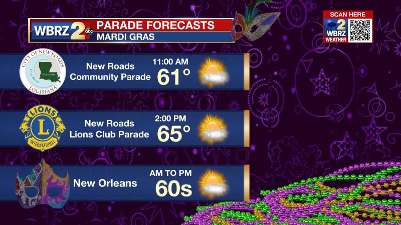
Local Mardi Gras Parades: From New Roads to New Orleans, weather will be cooperative for Mardi Gras. Plan to dress in layers, especially if heading out to get a spot early. Temperatures will begin in the upper 30s and low 40s but quickly warm into the 60s by lunchtime. Skies will be mostly sunny.
Up Next: Aside from a few high, thin clouds, skies are expected to stay mostly clear through the end of the (shortened) workweek. Continued lower humidity will cause a large range from low to high temperatures. Wednesday and Thursday, lows will be in the upper 30s and low 40s followed by highs in the mid 70s. By Friday, numbers will tick up a bit and highs could reach the 80s Saturday through Monday. Additionally, moisture will start to increase later Friday and some isolated showers could develop by Sunday or Monday. CLICK HERE for your detailed 7-Day Forecast.
Trending News
The Explanation: An area of surface high pressure will remain parked over the central Gulf Coast through the middle of the week. Upper level winds will be west to northwest resulting in a continued dry air mass. A few weak, upper level disturbances could occasionally result in some passing cirrus clouds. The combination of a surface high producing light, northerly winds and dry upper level winds will result in an overall dry atmosphere and therefore large diurnal range in temperatures through Thursday. An upper level ridge over the central U.S. will push east on Thursday and Friday as the surface high pressure system moves toward the U.S. East Coast. Surface winds will shift onshore and the upper level ridge will promote sinking air. Tis combination will lead to warming temperatures from late week into the weekend. Friday through the weekend, high temperatures will have a chance at 80 degrees while low temperatures will move into the 50s and 60s. A week upper level disturbance will track well north of our area on Sunday and Monday. With this, the ridge may break down just enough for some instability to overcome the lack of a real trigger for a shower or thunderstorms. By Monday and Tuesday, a frontal system will get closer to the area and that would then provide the lift needed for a few showers and thunderstorms to develop.
--Josh
The Storm Station is here for you, on every platform. Your weather updates can be found on News 2, wbrz.com, and the WBRZ WX App on your Apple or Android device. Follow WBRZ Weather on Facebook and Twitter for even more weather updates while you are on the go.
More News
