

Latest Weather Blog
Heat and showers minus the wrench
On Wednesday, an intense morning thunderstorm over Lake Pontchartrain lingered in neighboring parishes and had a significant effect on the temperature forecast. For Thursday, the morning began much quieter meaning the weather should shape up as forecast. While the August steam and shower machine is in full force, there are signs that a little shift may be in store next week.
Today and Tonight: For Thursday, a fast warm up will bring highs in to the mid 90s by midday. Feels-like temperatures will be in the low 100s—especially where showers fail to fall. Skies will be partly sunny away from the typical pop-up activity. Overnight, a few clouds may linger above with low temperatures stopping in the mid 70s.
Up Next: Friday and Saturday will continue the same pattern. Expect partly sunny skies with scattered afternoon showers and thunderstorms. Highs will be in the mid 90s with lows in the mid 70s. Outdoor activities should be able to go on this weekend but please have an indoor option nearby in the event that one of those summer storms brings lightning into the area. Storm or not, neither day should be a washout. By the middle of next week a more unsettled and slightly cooler pattern is expected to unfold.
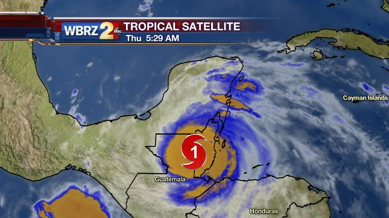
The Tropics: Hurricane Earl made landfall near Belize City, Belize just after midnight Thursday. The storm is expected to continue weakening through Thursday as heavy rain and gusty wind continue in Belize, Guatemala and over the Yucatan Peninsula. Earl will continue on a westward track, perhaps briefly emerging over the Bay of Campeche with a short window for re-strengthening, but as this time, it is not even expected to bounce back to tropical storm status. Again, there will be no impact on the local area.
Trending News
THE SCIENCE:
Forecast Discussion: Barely detectable ripples of energy riding beneath the upper level ridge have been kicking out showers and thunderstorms over the last few days. The activity has been quite isolated and primarily on the periphery of the ridge near the Louisiana and Mississippi Coasts. Forecast models continue to show the ridge in place today. Again, a small area of positive vorticity may cycle through northern and eastern locations late and help to enhance some shower and thunderstorm development. The same scenario is noted through Saturday with diurnal heating being the main trigger for convection. Speaking of heat, where showers and thunderstorms do not get going, mid 90s are well within reach for high temperatures. Overnight lows won’t cool much, leaving many areas just below 80 degrees. By the middle of next week, both the GFS and ECMWF show a vigorous trough crossing the Northern Gulf of Mexico. If this holds, rain coverage would significantly increase for the middle of the week and thus high temperatures would be backed down a bit.
--Josh
For updates, stay connected with Meteorologist Josh Eachus:
More News
