

Latest Weather Blog
Tuesday Afternoon Video Forecast
Related Story
Tuesday brings more summer heat and storms to South Louisiana; most thunderstorms will develop during the afternoon. Storms will be fewer and faster-moving than Monday, while temperatures stay closer to normal and the heat threat remains just below advisory levels.

Today and Tonight: Look for a mix of sun, clouds, and scattered afternoon thunderstorms across the Capital Region. Storm coverage should be a little less widespread than Monday. A few storms could still become strong, but the overall severe threat is lower. Heavy downpours may briefly overwhelm poor drainage, but faster storm movement should keep the flood threat much lower than it was Monday.

Use the slider to advance through the next 24 hours of Futurecast
Highs will reach the low to mid-90s, with heat index values around 105, remaining just below Heat Advisory levels. Storms should fade during the evening, although a few showers could linger into tonight.
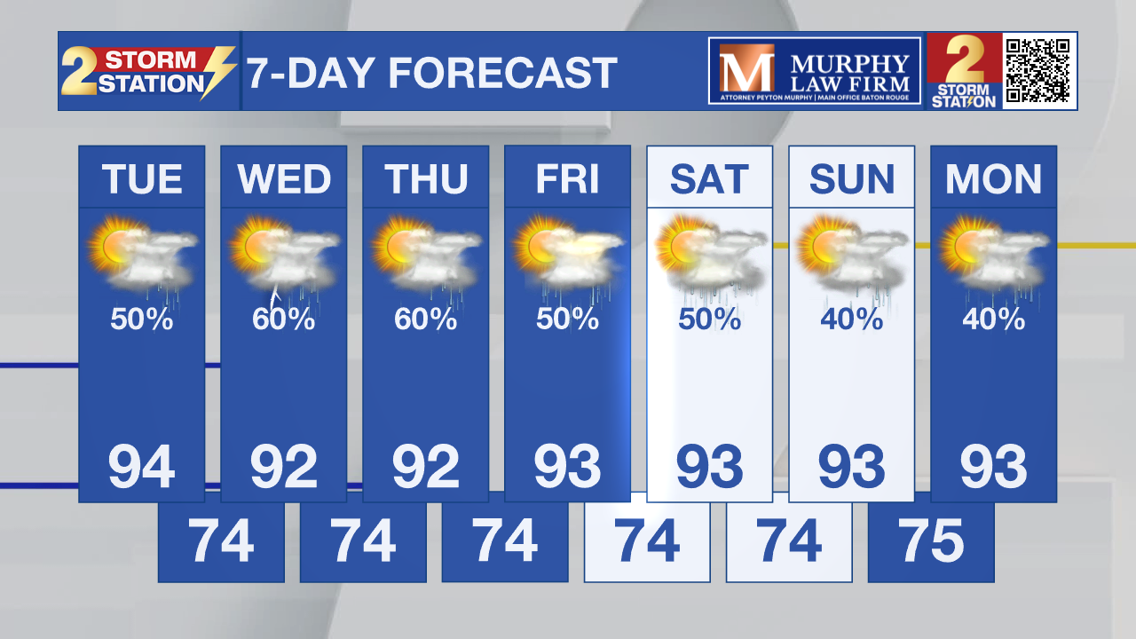
Up Next: Wednesday will bring another round of scattered afternoon storms with temperatures again running in the lower 90s. The more noticeable change arrives Thursday and Friday as deeper Gulf moisture returns and storm coverage increases. Rain chances could jump again later this week, with slower-moving storms that can produce heavy downpours. Much of the same is expected in the long-term forecast, although some "fall-like" changes are showing up in extended models!
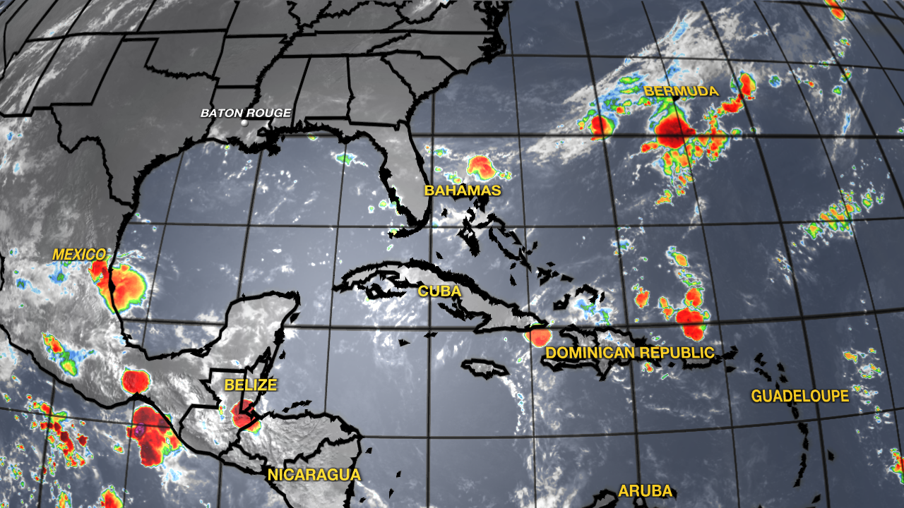
Tropics: The National Hurricane Center does not expect any tropical cyclone formation in the Gulf, Caribbean Sea or Atlantic during the next seven days.
– Dave
Get the latest 7-day forecast and real-time weather updates HERE.
Watch live news HERE.
The Storm Station is here for you, on every platform. Your weather updates can be found on News 2, wbrz.com, and the WBRZ WX App on your Apple or Android device. Follow WBRZ Weather on Facebook and X for even more weather updates while you are on the go.
News

