

Latest Weather Blog
Thursday morning video forecast
Related Story
Through the weekend, we will keep the above average temperatures, and a good amount of clouds. We will also feature increased rain chances, with isolated showers and storms being possible on Sunday.

Today & Tonight: An area of low pressure lingering in the open Gulf is still pushing clouds into coastal Louisiana and Mississippi. If you're near the coast, expect thicker cloud cover to stick around a little longer, keeping afternoon highs in the upper 60s to low 70s. Head farther inland, though, and thinner clouds with a few peeks of sunshine will let temperatures climb into the mid-to-upper 70s. Clouds will hang on tonight tonight, with lows dipping into the upper 50s
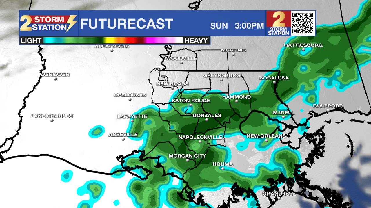
Use the slider to advance through the next 24 hours of Futurecast
Up Next: Quiet weather holds steady through Friday and Saturday, with partly to mostly cloudy skies and highs climbing into the upper 70s. Rain chances sit at just 10% for a few light showers or sprinkles.
By Sunday, a weak cold front drops in from the north, bringing increased rain chances. You won't have to cancel outdoor plans—there will still be plenty of dry stretches and highs in the mid-to-upper 70s—just watch out for a brief passing shower or storm.
Things get more complicated next week thanks to a potential tropical system developing off the East Coast. If that system pulls Sunday’s front farther south, drier air will filter in and keep Monday through Wednesday mostly rain-free. On the flip side, if the front stalls closer to the coast, an incoming system from the west could spark rounds of rain during that same stretch, potentially slowing down holiday travel. Forecast confidence will improve over the weekend once weather balloons better sample the upper-level pattern driving these systems. Regardless of how the rain plays out, cooler air is moving in early next week, dropping highs into the 60s and overnight lows into the 50s.
Get the latest 7-day forecast and real-time weather updates HERE.
Watch live news HERE.
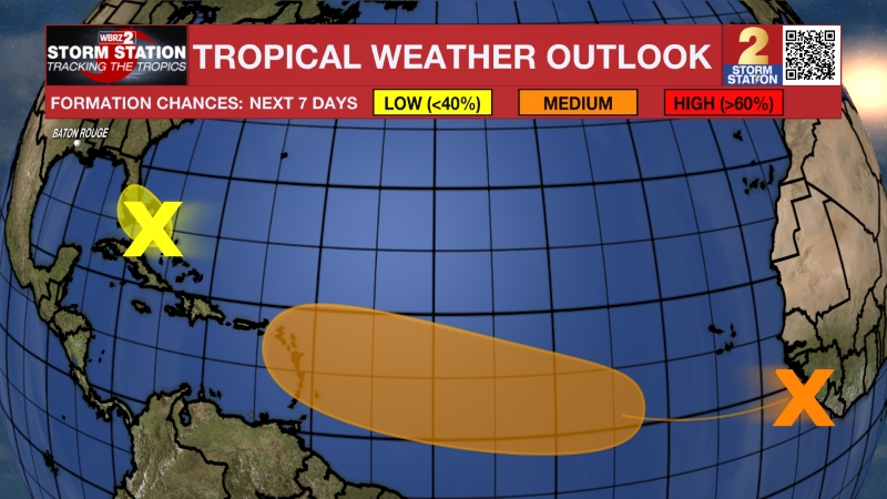
The Tropics: A non-tropical low pressure system is expected to form near the northern Bahamas by late Friday. This system could become a subtropical or tropical storm while it moves northward or northeastward near or just offshore of the southeastern U.S. coast through the weekend. Regardless of development, strong winds, dangerous surf, and coastal flooding are likely along portions of the southeast and mid-Atlantic coasts into early next week. Interests along the eastern U.S. coast should monitor the progress of this system.
– Balin
The Storm Station is here for you, on every platform. Your weather updates can be found on News 2, wbrz.com, and the WBRZ WX App on your Apple or Android device. Follow WBRZ Weather on Facebook and X for even more weather updates while you are on the go.
News

