

Latest Weather Blog
Sunday Evening Video Forecast
Related Story
The new workweek will bring a continuation of the fire weather danger along with the threat of freezing temperatures. Both impacts will be short-lived, however.
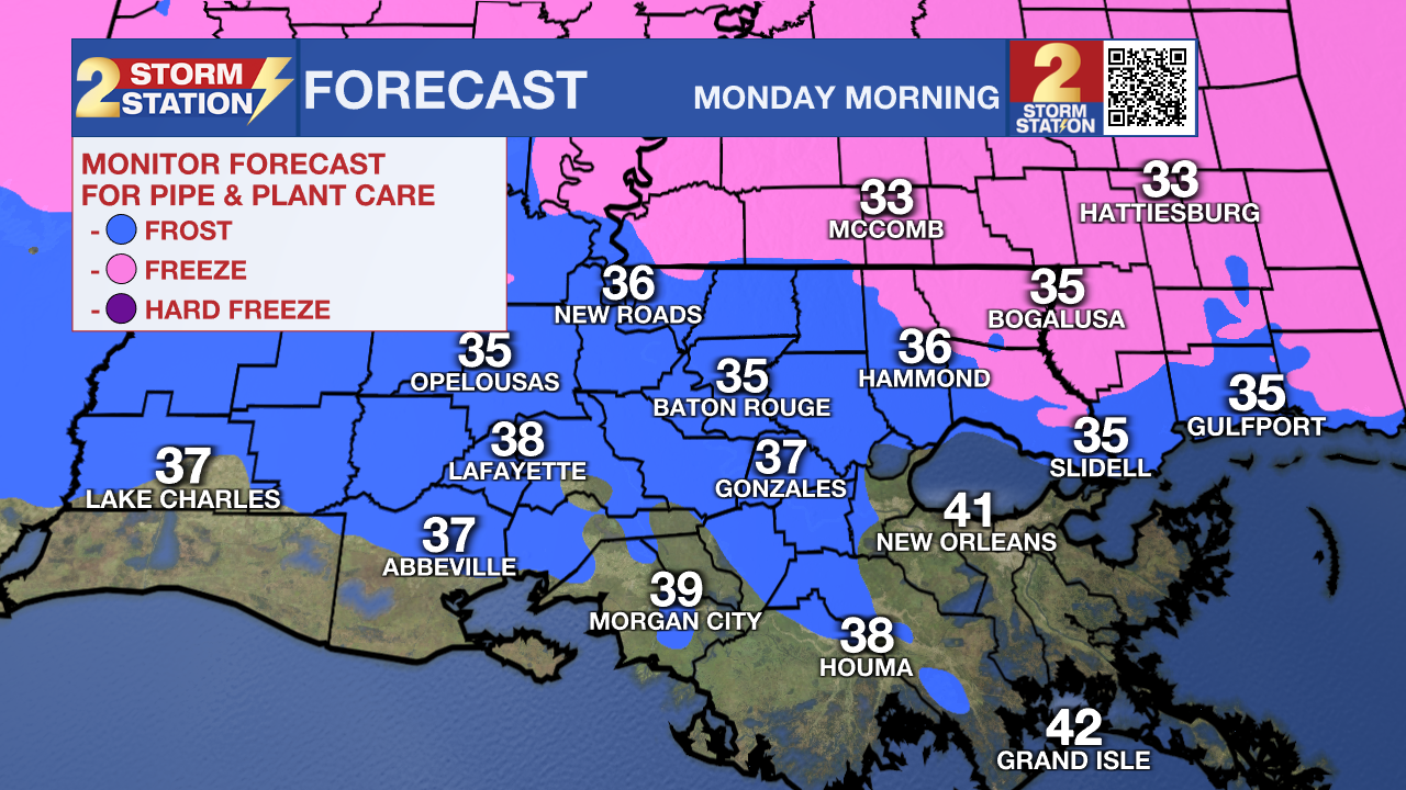
Tonight: Clear skies and a northerly breeze will send overnight lows into the mid-30s across the Baton Rouge Metro, with a few spots near the state line flirting with freezing. Normally, that would be cold enough to support frost formation, but a steady north wind at 5–10 mph should keep frost to a minimum. Nevertheless, many have already planted ahead of spring, and with some plants beginning to emerge from dormancy, tender vegetation will need protection. Cover sensitive plants or bring potted ones indoors to prevent damage. That wind will add an extra bite to the air. Wind chills early Monday morning will dip below freezing. Break out the heavy coats if you’re heading to work or waiting at the bus stop.
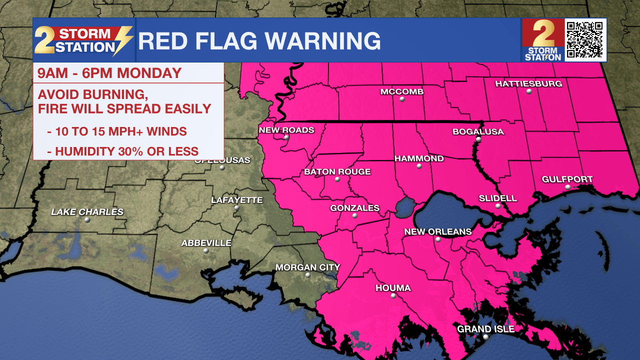
Tomorrow: Sunshine will dominate from start to finish on Monday. Despite the bright skies, temperatures will struggle to climb. Afternoon highs will find the mid-to-upper 50s with a persistent northerly wind at 10-15 mph. The breezy conditions, in addition to very dry air, require another Red Flag (Fire Weather) Warning from 9 a.m. to 6 p.m. Monday. Any fire that develops will catch and spread quickly in such conditions. Avoid outdoor burning, dispose of cigarettes appropriately, and try to avoid parking over dry grass. The fire weather danger will lessen after dark.
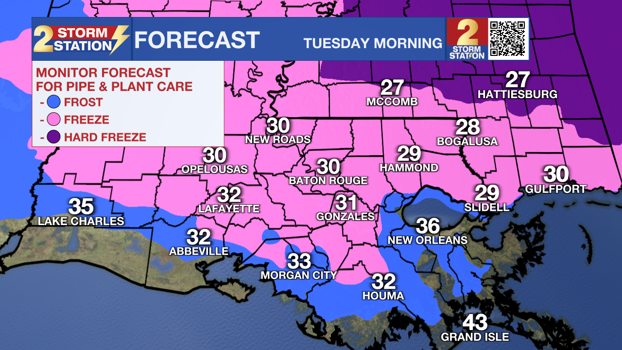
Up Next: The coldest morning of the week will be Tuesday, when a light freeze looks likely in many locations. Plants will need protection from the cold for another night, and don’t forget to take care of people and pets as well. After the early-week chill, temperatures will rebound quickly. Look for highs in the 70s and possibly touching 80° by mid-to-late week ahead of the next cool front. This front is expected to bring showers and thunderstorms sometime Thursday or Thursday night. Behind it, the cooldown won’t be nearly as dramatic. Highs look to settle in the 70s from Friday into the weekend, keeping things seasonably warm rather than sharply colder.
Get the latest 7-day forecast and real-time weather updates HERE.
Watch live news HERE.
— Meteorologist Malcolm Byron
The Storm Station is here for you, on every platform. Your weather updates can be found on News 2, wbrz.com, and the WBRZ WX App on your Apple or Android device. Follow WBRZ Weather on Facebook and X for even more weather updates while you are on the go.
News
