

Latest Weather Blog
Monday morning video forecast
Related Story
The wet pattern continues to wind down this week as upper-level high pressure brings lower rain chances and warmer temperatures to South Louisiana. Storm coverage stays limited this week, with the heat building before a more unsettled weekend and a tropical disturbance potentially entering the Gulf.

Today and Tonight: Monday will be hot and humid with highs in the mid-90s and heat index values between 103° and 108°. A few isolated to scattered showers and thunderstorms will develop during the afternoon and early evening.

Use the slider to advance through the next 24 hours of Futurecast
Up Next: Tuesday looks to be fairly dry, with only a few spotty storms possible. Rain chances increase Wednesday and Thursday slightly, but the bigger story will be the heat, with highs remaining in the mid 90s and heat index values potentially approaching Heat Advisory criteria.
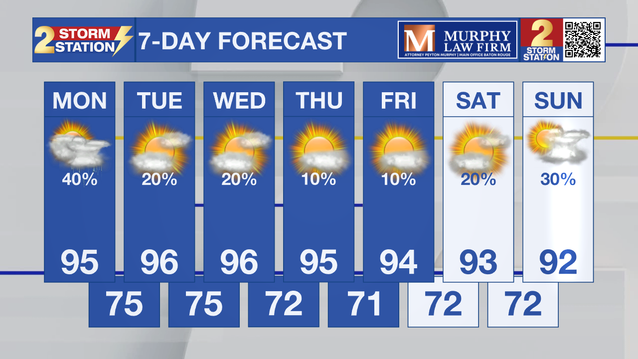
By late week, stronger easterly winds will develop as high pressure builds to our north. The weekend brings a bigger change as a wave moves into the Gulf, bringing scattered showers and thunderstorms by the end of the weekend.

Tropics: The National Hurricane Center is watching a disturbance in the central subtropical Atlantic more than 1,000 miles east-southeast of Bermuda. Development is unlikely through Tuesday, but conditions could become more favorable later this week, with a 30% chance of formation over the next seven days.
– Dave
Get the latest 7-day forecast and real-time weather updates HERE.
Watch live news HERE.
The Storm Station is here for you, on every platform. Your weather updates can be found on News 2, wbrz.com, and the WBRZ WX App on your Apple or Android device. Follow WBRZ Weather on Facebook and X for even more weather updates while you are on the go.
News

