

Latest Weather Blog
Wednesday PM Forecast: coolest morning in three months expected later this week
To end the week, we will get the first sign that the summer steam machine has an off switch. Drier air will sweep into the Capital Area on Thursday. While high temperatures will still climb into the mid-90s each afternoon, lower humidity will keep the heat index down and allow low temperatures to hit the 60s north of the interstates.
Humidity Relief: less steamy afternoons with coolest mornings in months
Drier Trend: several days without rain likely
Back to Summer (Into Fall): humidity, pop-up storms return for the new season
.png)
Trending News
Tonight & Tomorrow: The lower humidity is somewhat lagging behind a weak front that pushed through and changed the wind to a northeasterly direction on Wednesday. As a result, tonight will stay muggy and warm with lows in the mid 70s. On Thursday, expect sunshine and breezy conditions, with easterly winds gusting between 15 and 20 mph. High temperatures will reach 95 degrees, but lower dew points into the 60s will make it feel much less steamy than recent days. Rather than 100 – 105, the feels-like temperature will be 95 – 100 degrees.
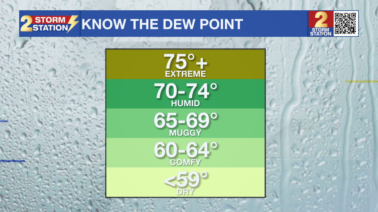
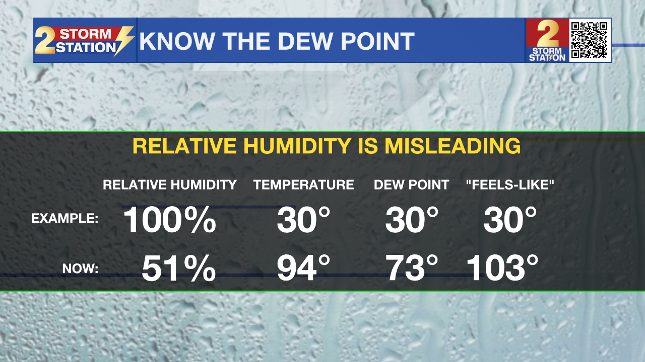
Recall that the dew point temperature serves as a much truer gauge of the humidity, as the relative humidity is just that, relative to the temperature, making it a sliding scale. The dew point temperature scale does not change, so when the numbers are in the 70s, it is humid, and when the numbers are in the 60s, it feels drier.
 |
 |
Up Next: On Friday and Saturday mornings, some neighborhoods north of the interstates will wake up to temperatures below 70 degrees for the first time since June 5. Thanks to that lower humidity, the afternoons will be mainly sunny and dry but warm, with highs in the mid 90s. Expect relatively pleasant and cooperative weather for both the Friday Night Blitz and Southern Jaguars. Expect evening temperatures to be falling through the 80s into the 70s.
Some moisture will creep back into the atmosphere by Sunday. This means not only will our mini taste of fall relief start to fade, but daytime warming will again be able to pop isolated showers and thunderstorms. Rain coverage will stay on the lower end into early next week, never really exceeding 30 percent any one day. Both high and low temperatures will be a few degrees above average in the low 90s and low 70s, respectively. Tuesday marks the official beginning of astronomical fall.
Get the latest 7-day forecast and real-time weather updates HERE.
Watch live news HERE.

The Tropics: The Caribbean and Gulf will remain quiet over the next 7 days. Elsewhere, an area of low pressure located several hundred miles east of Bermuda has been designated as Invest AL98. Environmental conditions may allow for slow development over the next few days as this system drifts slowly westward to southward over the open waters of the Central Subtropical Atlantic. This disturbance remains thousands of miles away from the United States coastline and poses no threat to the Gulf Coast.
– Josh
The Storm Station is here for you, on every platform. Your weather updates can be found on News 2, wbrz.com, and the WBRZ WX App on your Apple or Android device. Follow WBRZ Weather on Facebook and X for even more weather updates while you are on the go.
More News

