

Latest Weather Blog
Tuesday AM Forecast: Mild Weather Holds Before a Big Weekend Cooldown
The region stays mostly dry through the middle of the week, although a few sprinkles or light showers are possible. A strong cold front arrives early Thursday, bringing much cooler temperatures by the weekend.

Today and tonight: Expect a mix of clouds and sunshine across the Capital Region Tuesday. A few sprinkles or light showers can't be ruled out as an upper disturbance moves through, but the atmosphere is very dry near the ground, so much of that moisture will evaporate before reaching the surface. Most areas should stay dry, with afternoon temperatures in the 70s to near 80.
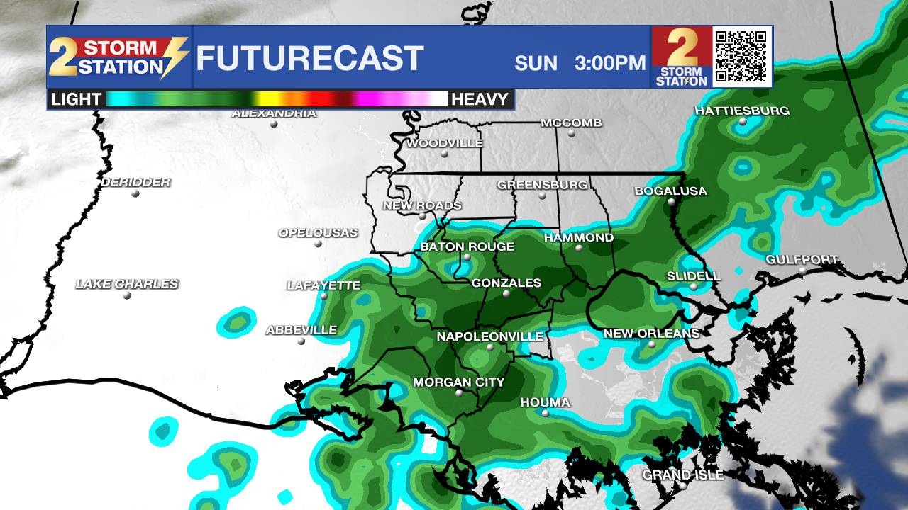
Use the slider to advance through the next 24 hours of Futurecast
Up Next: A few more light showers or sprinkles are possible early Wednesday, but meaningful rainfall is unlikely. A stronger cold front will move through early Thursday, bringing much drier and colder air. The front itself is expected to be dry.
Trending News
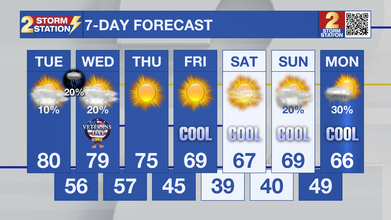
Friday will feel noticeably cooler, with highs mainly in the 60s and morning temperatures in the 40s and 50s. The coldest mornings look to be Saturday and Sunday. Temperatures could fall into the 30s across inland areas, with some typical cold spots potentially reaching the lower 30s. Patchy frost is possible, especially Saturday morning. The extended forecast also shows a possible opportunity for rain early next week, but confidence in that system and how much rain reaches our area remains low.
Tropics: The National Hurricane Center says tropical cyclone formation is not expected in the Atlantic, Caribbean Sea, or Gulf over the next seven days.
- Dave
Get the latest 7-day forecast and real-time weather updates HERE.
Watch live news HERE.
The Storm Station is here for you, on every platform. Your weather updates can be found on News 2, wbrz.com, and the WBRZ WX App on your Apple or Android device. Follow WBRZ Weather on Facebook and X for even more weather updates while you are on the go.
More News

