

Latest Weather Blog
Friday PM Forecast: Coolest morning start since May on Saturday, low humidity continues
Expect a pleasant stretch of weather through the weekend, featuring cooler mornings and warm afternoons. With lows dipping into the mid-60s, it’ll be our coolest temperatures since back in May.
Tonight & Tomorrow: Mostly clear skies and lower humidity air will allow temperatures to quickly drop tonight. Lows are expected to reach the mid-60s, which are the coolest temperatures since May. While the daytime hours on Saturday will still be warm with highs in the low 90s, it will be tolerable considering the lower humidity. Tailgaters should have zero issues, given no rain is expected. Kickoff temperatures for the LSU game will be in the low to mid-80s. By the final whistle, temperatures will slip back into the mid-70s. Overall, it should be a great night for some football!

Up Next: Another cooler start is expected on Sunday, with the daytime hours once again being warm and mainly dry. We start to see some changes early next week as winds flip out of the south. This will allow a bit higher moisture to creep into the region. Lows will begin to increase, and there will be a few showers and storms each afternoon.
A storm system rolling in from the west by Wednesday is set to bring higher humidity and a better chance of showers and storms. We might even see a more distinct front push through, which could give us a break from the heat toward the end of next week. That said, recent weather models have been backing off on the front actually making it through, but it’s definitely something we'll keep an eye on.
Trending News
Get the latest 7-day forecast and real-time weather updates HERE.
Watch live news HERE.
The Tropics: There are two active tropical systems in the Atlantic basin. The first is Tropical Storm Gonzalo. This storm hasn't changed much today, holding steady as a weak tropical storm with 50 mph winds as it moves north at about 11 mph. The storm is currently stretched out and lopsided, with its heavy rain and thunderstorms pushed well to the northeast of its center due to strong, disruptive winds aloft. Over the next couple of days, Gonzalo will continue on a northward path between two larger weather systems, but it is expected to slow down as it weakens. Stronger wind shear and cooler ocean waters will begin tearing the storm apart by Saturday morning, causing it to lose its organized thunderstorm activity and fade into a weak, non-tropical low-pressure system by Sunday.
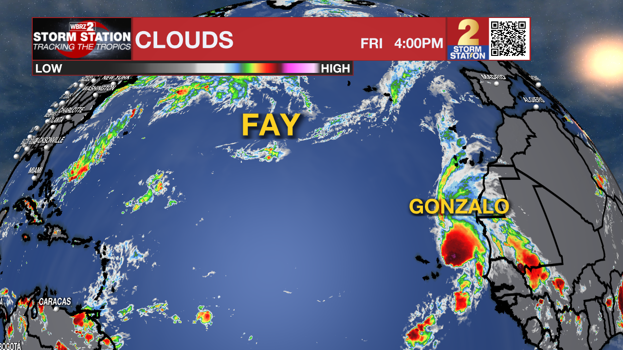
The other system is Tropical Storm Fay. This storm is starting to unravel as it battles strong, disruptive winds and dry air, causing its top winds to drop down to around 50 mph. As these harsh upper-level winds push dry air into the center of the storm, Fay will steadily lose its heavy rain and thunderstorm activity, likely fading into a weak, non-tropical remnant low by the end of the weekend—or possibly even sooner. Driven by a high-pressure system over the central Atlantic, the weakening storm is moving west-southwest at a slightly faster pace of around 5 mph and is expected to stay on this path as it continues to lose strength over the coming days.
– Balin
The Storm Station is here for you, on every platform. Your weather updates can be found on News 2, wbrz.com, and the WBRZ WX App on your Apple or Android device. Follow WBRZ Weather on Facebook and X for even more weather updates while you are on the go.
More News

