

Latest Weather Blog
'Zipper in the sky:' Unique cloud feature spotted across Baton Rouge skies
Related Story
Several Storm Station viewers spotted an interesting cloud feature in the sky on Wednesday. Rebecka Miller saw the strange cloud formation over Morgan City, noting that it looked like a “zipper in the sky.”
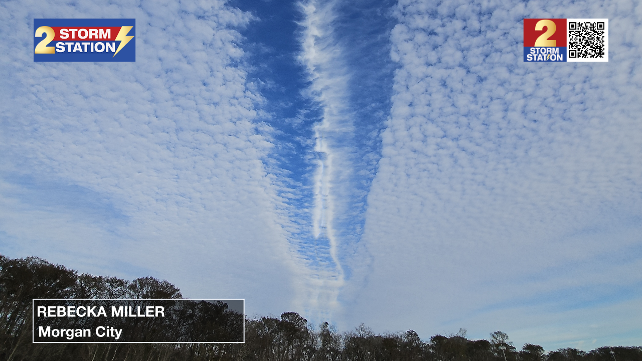
Photos reveal a deck of cirrocumulus clouds (high clouds with a lumpy appearance) being separated by a sudden line of clearing. Within this line of clearing, we find embedded cirrus clouds (thin, wispy clouds composed of ice crystals).
This feature is known as a distrail – short for dissipation trail. Distrails form when planes fly through a cloud composed of both supercooled water and ice. The disruption of the airflow created by the aircraft allows the water to evaporate and deposit onto the ice crystals. The removal of the water droplets produces a sharp line of clearing with clouds composed of ice mixed in.
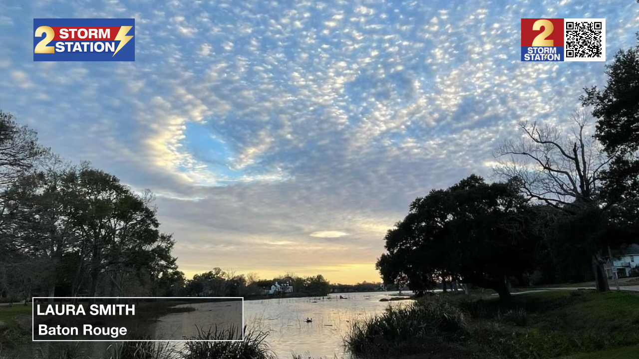
Another photo from Wednesday afternoon reveals a similar phenomenon known as a hole punch cloud. The formation process is exactly the same but occurs when aircraft passes through a water/ice cloud during takeoff or landing. Hole punch clouds have more of a circular appearance.
The Storm Station is here for you, on every platform. Your weather updates can be found on News 2, wbrz.com, and the WBRZ WX App on your Apple or Android device. Follow WBRZ Weather on Facebook and Twitter for even more weather updates while you are on the go.
News
