

Latest Weather Blog
Wednesday Morning Video Forecast
Related Story
With the big Thanksgiving holiday tomorrow, weather is looking comfortable and cool enough to break out any holiday sweaters you might want wear. The next several mornings start off chilly with temperatures in the 40s and there's a slight chance to see a passing rain shower Thursday afternoon and on Sunday.
Today & Tonight: Sunshine returns with a mix of clouds hanging around today. We will be noticeably cooler throughout the day, with temperatures this morning around the state in the upper-40s to lower 50s that will only climb near the 60° later this afternoon. Winds remain out of the northwest at 5-10mph and roads will be dry making for nice holiday travel conditions. Clouds will begin to increase later on Wednesday and temperatures will tumble into the 40s once again overnight for a chilly start to your Thanksgiving.
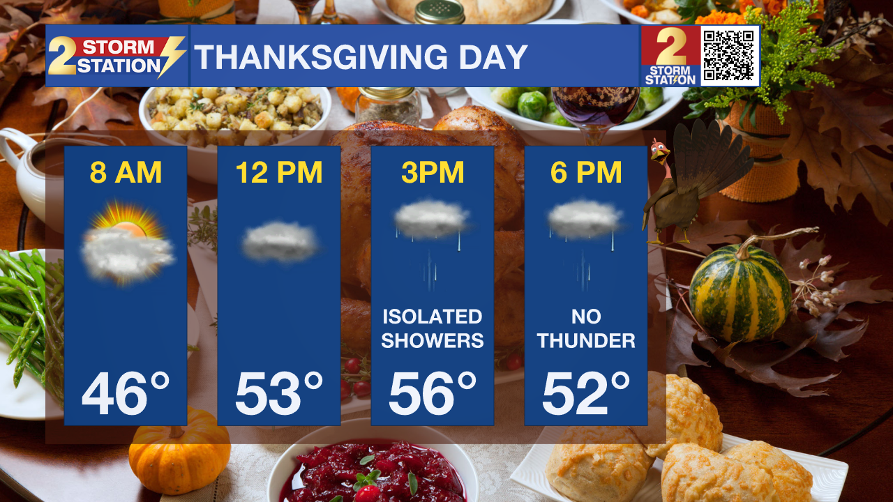
Up Next: Thanksgiving Day will see mainly overcast skies keeping temperatures more than 10 degrees below average, climbing into the mid to upper 50s tomorrow afternoon. By late in the day on Thursday, a very weak system moving across the Gulf of Mexico could spit just enough moisture across the central Gulf Coast for a couple of showers to develop across southern Louisiana. Isolated showers may linger right into Friday morning before that system departs. About 24-36 hours of quiet weather is then expected headed into the weekend. Friday afternoon will offer some sun and highs in the mid 60s. Saturday morning will begin chilly with low in the mid 40s. The weather will be cool – literally and figuratively – for the Bayou Classic and LSU’s final home game. With some sun, morning temperatures will rise out of the 40s, through the 50s and catch the mid to upper 60s by afternoon. We will see another chance of showers on Sunday as a quick moving disturbance passes by.
Get the latest 7-day forecast and real time weather updates HERE.
Watch live news HERE.
The Tropics: An area of low pressure is expected to develop along a frontal boundary over the central subtropical Atlantic within the next day or so. This non-tropical low is forecast to move southeastward across the central subtropical Atlantic over warmer sea surface temperatures during the next few days, and environmental conditions could allow for this system to gradually acquire tropical or subtropical characteristics. A subtropical or tropical storm could form by the latter part of this week or this weekend, as the system turns northeastward by the weekend.
– Emma Kate Cowan
The Storm Station is here for you, on every platform. Your weather updates can be found on News 2, wbrz.com, and the WBRZ WX App on your Apple or Android device. Follow WBRZ Weather on Facebook and Twitter for even more weather updates while you are on the go.
News
