

Latest Weather Blog
Wednesday evening video forecast
Related Story
After a very cold night, warming temperatures will be the trend through the weekend into early next week. Rain remains hard to find.
A ***FREEZE WARNING*** is in effect from 1 - 8am Thursday for all of southwest Mississippi and neighboring parishes in Louisiana. Sub-freezing temperatures as low as 32 could kill crops, other sensitive vegetation and possibly damage unprotected outdoor plumbing. Take steps now to protect tender plants from the cold. To prevent freezing and possible bursting of outdoor water pipes they should be wrapped, drained, or allowed to drip slowly. Those that have in-ground sprinkler systems should drain them and cover above-ground pipes to protect them from freezing.
Tonight & Tomorrow: Clear skies, calm winds and dry air will setup ideal cooling conditions overnight. Locations along and north of I-12 are expected to drop below freezing and a few isolated spots south of the interstate may reach the mark as well. With the coldest temperatures so far this season expected, it is a good idea to take freeze and frost precautions for plants and animals anywhere north of I-10. Thursday will be sunny and begin a warming trend in the Capital Area as high temperatures move into the upper 60s. A few high clouds could get into the mix, but that is about it.
Up Next: Friday will not start off nearly as chilly with low temperatures in the low 40s. More sun will drive high temperatures back to average in the mid 70s during the afternoon. The climb will continue on a mainly clear weekend with lows in the upper 40s and low 50s and highs in the upper 70s and low 80s. By early next week, thermometers will be running about 5-10 degrees above the seasonal averages of 75 and 51 with partly cloudy skies. The next earliest, small chance for a shower will come on Tuesday as a weak front stalls north of the area.
Get the latest 7-day forecast and real time weather updates HERE.
Watch live news HERE.
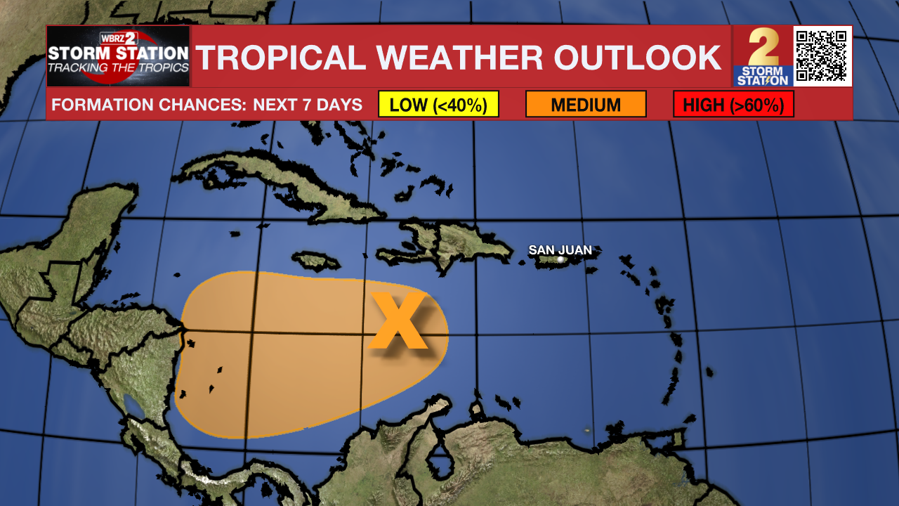
The Tropics: Disorganized showers and thunderstorms over the central Caribbean Sea are associated with a trough of low pressure. Environmental conditions could become a little more conducive for development in a day or two, and a tropical depression could form when the system moves over the southwestern Caribbean Sea during the latter part of this week. Regardless of development, this system has the potential to produce heavy rains over portions of Central America late this week and into the weekend.
– Josh
The Storm Station is here for you, on every platform. Your weather updates can be found on News 2, wbrz.com, and the WBRZ WX App on your Apple or Android device. Follow WBRZ Weather on Facebook and Twitter for even more weather updates while you are on the go.
News
