

Latest Weather Blog
Wednesday evening video forecast
Related Story
After a beneficial soak for much of the Capital Area, rain will end overnight. The rest of the week will be mild as we await another cold front into the weekend.
Tonight & Tomorrow: Rain will end from west to east on Wednesday evening. Partial clearing is expected overnight as breezes remain elevated out of the northeast at 10-15mph. Low temperatures will settle in the upper 50s. Thursday will be partly sunny and quiet with only a minimal chance for a coastal shower. Winds will settle down as well. High temperatures will be seasonable in the low 80s.
Up Next: Another front will approach the area on Friday. Ahead of this feature, temperatures will warm up efficiently with highs in the upper 80s. A stripe of clouds, and perhaps a spotty shower, will precede the front through the late afternoon and overnight hours. By Saturday morning, the front will be moving east of the region and skies will start to clear out. The weather left behind will be very cooperative with all the outdoor events. Viewing should be great for the partial eclipse late Saturday morning into the afternoon. Be sure to gaze safely. For the college football games this weekend, an outer layer may be wanted for morning tailgating or in the stadiums during the evening hours. That won’t be necessary during the middle of the day though as temperatures will work into the low 80s. Sunday will be a little cooler with more distance behind the front and lows will be in the low 50s followed by highs in the mid 70s. A reinforcing shot of cool air could send temperatures a few degrees cooler early next week as skies stay clear.
Get the latest 7-day forecast and real time weather updates HERE.
Watch live news HERE.
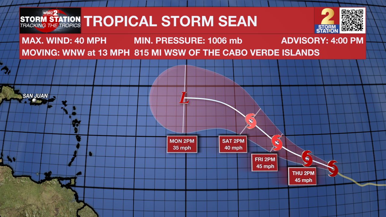
The Tropics: Tropical Storm Sean continues west-northwest over the open, eastern Atlantic Ocean at 10-15mph with maximum sustained winds of 40mph. Sean will maintain a similar strength and motion over the next several days and is not a threat to any land.
A broad area of low pressure located several hundred miles to the south-southeast of the Cabo Verde Islands is producing a large area of showers and thunderstorms. Environmental conditions appear to support slow development over the next few days as this system moves westward across the eastern and central tropical Atlantic through early next week.
– Josh
The Storm Station is here for you, on every platform. Your weather updates can be found on News 2, wbrz.com, and the WBRZ WX App on your Apple or Android device. Follow WBRZ Weather on Facebook and Twitter for even more weather updates while you are on the go.
News
