

Latest Weather Blog
Wednesday evening video forecast
Related Story
On Wednesday, showers and thunderstorms very clearly trended fewer and farther between with most of the action staying east of the Metro Area. For this reason, serious heat is a growing concern and will be for the next several days.
A *HEAT ADVSIORY* will be in effect on Thursday from 10am - 8pm for all of southeast Louisiana. Heat index values up to 112 may cause heat illnesses to occur.
Drink plenty of fluids, stay in an air-conditioned room, stay out of the sun, and check up on relatives and neighbors. Young children and pets should never be left unattended in vehicles under any circumstances. Take extra precautions if you work or spend time outside. When possible reschedule strenuous activities to early morning or evening. Know the signs and symptoms of heat exhaustion and heat stroke. Wear lightweight and loose fitting clothing when possible. To reduce risk during outdoor work, the Occupational Safety and Health Administration recommends scheduling frequent rest breaks in shaded or air conditioned environments. Anyone overcome by heat should be moved to a cool and shaded location. Heat stroke is an emergency!
Tonight & Tomorrow: Overnight will be partly cloudy with low temperatures in the upper 70s. Some neighborhoods may not leave the 80s. Thursday will continue to crank up the steam machine and high temperatures in the upper 90s will combine with high humidity to produce feels-like temperatures between 107 – 113 degrees during the middle of the day. A stray shower or thunderstorm is possible, especially south and east of Baton Rouge.
Up Next: For the end of the week and into the weekend, an upper level ridge of high pressure will expand over the Gulf Coast leading to hotter temperatures and minimal showers and thunderstorms. Through at least Wednesday, highs will be in the upper 90s and lows will struggle to leave the 80s. This will mean plenty of humidity will stick around and afternoon feels-like temperatures over 107 degrees will likely warrant continuous heat alerts from the National Weather Service. If any two days stand a better chance at finding some cooling afternoon showers, it will be Sunday and Monday.
Get the latest 7-day forecast and real time weather updates HERE.
Watch live news HERE.
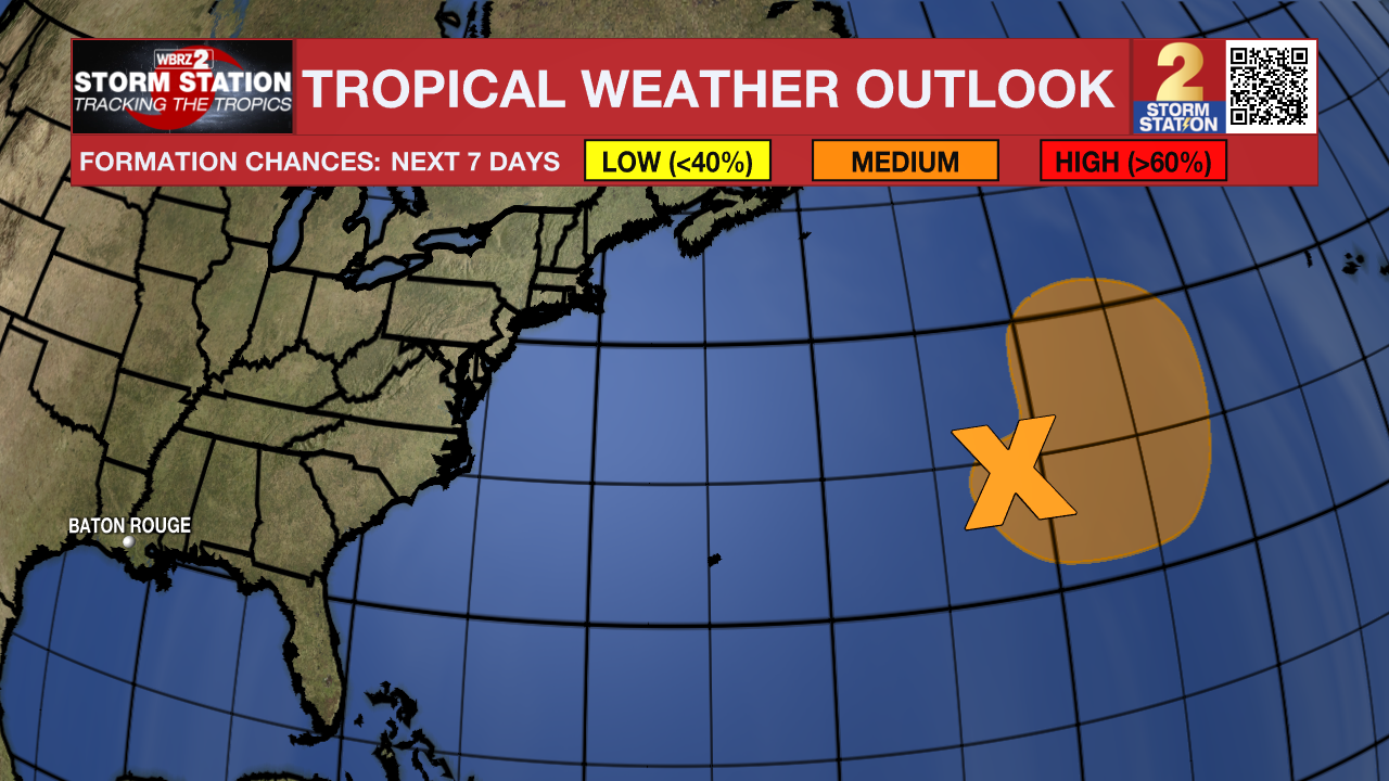
The Tropics: An area of low pressure located a little more than 700 miles east of Bermuda continues to produce disorganized showers and thunderstorms well to the south of its center. There is a fifty percent chance for this system to become a subtropical depression or storm during the next couple of days while it meanders over the central Atlantic. By the weekend, the low should turn northward bringing the system over cooler waters, potentially limiting additional development.
--Josh
The Storm Station is here for you, on every platform. Your weather updates can be found on News 2, wbrz.com, and the WBRZ WX App on your Apple or Android device. Follow WBRZ Weather on Facebook and Twitter for even more weather updates while you are on the go.
News
