

Latest Weather Blog
Tuesday evening video forecast
Related Story
Wednesday will mark the transition into a more active and unsettled weather pattern. Each day through the weekend will have at least some chance for showers and thunderstorms.
Tonight & Tomorrow: Expect clouds to continue increasing overnight. Added sky cover will lead to low temperatures staying in the upper 50s, several degrees warmer than previous mornings. Wednesday will be mostly cloudy with high temperatures jumping into the upper 70s and low 80s. Moisture increasing from the Gulf of Mexico will lead to isolated showers and thunderstorms flaring up in response to daytime warming.
Up Next: For the remainder of the workweek and through at least Saturday, temperatures will be a few degrees above average. Expect morning lows in the mid to upper 60s and afternoon highs in the low to mid 80s.
With plenty of moisture in place, an upper level disturbance moving across the area will instigate a little more action on Thursday. There is no threat for a washout and rain will still be isolated in nature.
By Friday, a slow moving cold front will move into the region, increasing showers and thunderstorms even further. In fact, the final day of the workweek will likely feature the highest coverage of rain across the Capital Area.
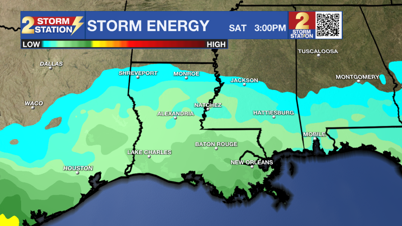
The cold front is expected to stall over the region Saturday and into Sunday maintaining the potential for scattered showers and thunderstorms. Indeed, there will be plenty of energy in the atmosphere that any rain could be accompanied by lightning. It is too early to call out specifically favored times for the showers and thunderstorms as much will hinge on the movement of the front. With a number of outdoor events slated for the weekend, it will be important to keep tabs on the Storm Station forecast, especially with regard to any possibility of lightning. Have an indoor contingency nearby in the event of a thunderstorm.
The cold front is expected to get a significant push south later Sunday. A final batch of rain and thunderstorms will press through followed by a substantial drop in temperatures for the beginning of next week. Thermometers will be several degrees below average which is mid 70s over low 50s for the time of year. Some more lows in the 40s are likely.
Get the latest 7-day forecast and real time weather updates HERE.
Watch live news HERE.
– Josh
The Storm Station is here for you, on every platform. Your weather updates can be found on News 2, wbrz.com, and the WBRZ WX App on your Apple or Android device. Follow WBRZ Weather on Facebook and Twitter for even more weather updates while you are on the go.
News
