

Latest Weather Blog
Tuesday evening video forecast
Related Story
The story for the remainder of the workweek will be seasonably dry conditions with low humidity and low rain chances. Drought will continue with a conditional threat for wildfires as well. It will be warm and dry enough but not too windy.
Tonight & Tomorrow: Overnight will be mostly clear and comfortable with low temperatures dipping into the mid 60s. These numbers fall just below average for the time of year. Another mainly clear afternoon is ahead on Wednesday. A few fair weather cumulus clouds may puff up, but that is about it. As the dry, low humidity conditions continue, feels-like temperatures will stay right in line with high temperatures in the low 90s.
Up Next: The extended forecast is uneventful. High temperatures won’t budge from day to day. Expect highs in the low to mid 90s through the weekend. Low temperatures will be in the mid to upper 60s through Thursday, with low 70s beyond that. At that time, humidity will begin to creep up but not back to peak summer levels. Without a ton of humidity and no major storm systems passing through, the forecast also looks completely dry for the workweek. There are some early signs that enough moisture will arrive in the atmosphere to support a shower or thunderstorms by the weekend. Slightly better, albeit low, rain chances will be possible as a weak cold front approaches the area on Monday and Tuesday.
Get the latest 7-day forecast and real time weather updates HERE.
Watch live news HERE.
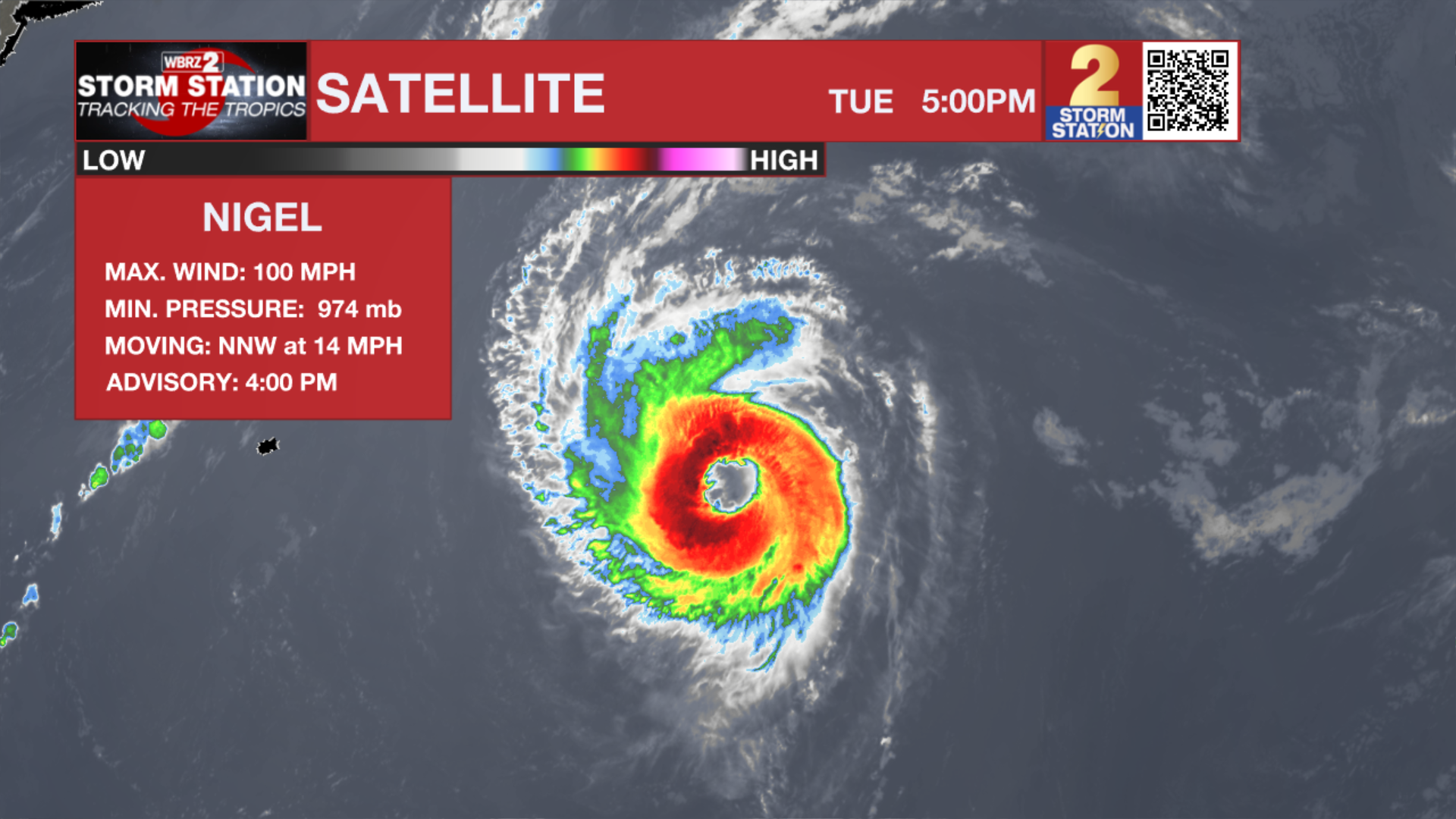
The Tropics: Hurricane Nigel continues to strengthen over the central Atlantic Ocean. With maximum sustained winds of 100mph, the storm is moving northwest at 10-15mph. Nigel will turn north by Wednesday and accelerate northeast through the rest of the week. Though some additional strengthening is possible, the storm will turn post-tropical by the end of the week. The only potential threat to land are high swells near Bermuda.
A tropical wave is expected to move off the west coast of Africa by Wednesday. Environmental conditions are forecast to be conducive for gradual development of the wave thereafter, and a there is a seventy percent chance that a tropical depression forms late this week or this weekend while the system moves generally westward across the eastern and central tropical Atlantic.
A non-tropical area of low pressure is expected to form east of the Florida peninsula late this week. This system could acquire some subtropical characteristics this weekend while it moves generally northward. Regardless of subtropical development, this low is likely to bring gusty winds, heavy rain, and high surf conditions to portions of the coastal Carolinas into the coastal Mid-Atlantic states late this week into this weekend.
–Josh
The Storm Station is here for you, on every platform. Your weather updates can be found on News 2, wbrz.com, and the WBRZ WX App on your Apple or Android device. Follow WBRZ Weather on Facebook and Twitter for even more weather updates while you are on the go.
News
