

Latest Weather Blog
Thursday Morning Video Forecast
Related Story
Expecting the last 90 degree high temperature for at least a week, possibly even the year, this afternoon. Cool and extremely dry air is en route and set to arrive just in time for the weekend.
Today & Tonight: We will heat up into the lower 90s one last time today with an increase in cloud cover, rain chances, and humidity levels. Tonight, expect isolated showers and storms to continue as a cold front will be making it's way through the state. Temperatures will remain in the 70s overnights as the chance for rain and increased cloud cover continues into Friday morning.
Up Next: Friday, not everyone will see rain and most of it will clear out by sunrise. There could be some spotty showers throughout the day on Friday and there will be a lot of cloud cover around. Temperatures will still be slightly above average on Friday before they really begin to drop on Saturday. High's on the weekend will be in the lower 80's and upper 70's. Lows will be in the lower 60's and middle 50's. The coolest morning in the next 7days looks to be on Monday where we could see lows in the lower 50's.
Get the latest 7-day forecast and real time weather updates HERE.
Watch live news HERE.
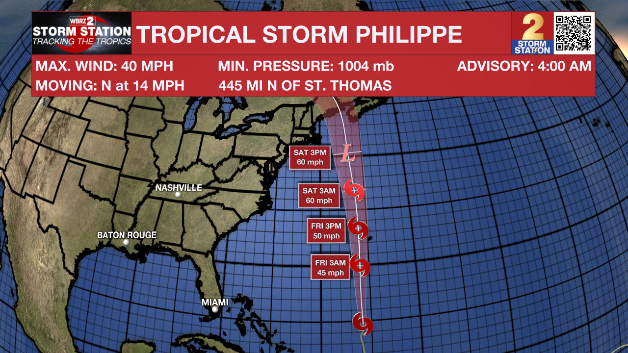
The Tropics: Tropical Storm Philippe is moving to the north at 14mph. It is forecast to approach Bermuda tonight and Friday. Some slight strengthening could come over open water later in the week as the latest track indicates that the storm could impact parts of New England late this weekend.
– Emma Kate Cowan
The Storm Station is here for you, on every platform. Your weather updates can be found on News 2, wbrz.com, and the WBRZ WX App on your Apple or Android device. Follow WBRZ Weather on Facebook and Twitter for even more weather updates while you are on the go.
News
