

Latest Weather Blog
Thursday morning video forecast
Related Story
Southerly winds will result in temperatures climbing above average temperatures and returning rain chances through the weekend. 70s are even possible by early next week.
THE FORECAST:
Today and Tonight: A bit more sunshine is anticipated for Thursday although some clouds will remain in play. As light, southeasterly winds begin, high temperatures will climb close to average in the low 60s. Overnight lows will be back above average in the upper 40s beneath mostly cloudy skies. Patchy fog is possible as well.
Up Next: Highs will be above average by Friday. Unfortunately, clouds will also continue increasing. An upper level disturbance will lead to showers across the area for part of the weekend. This storm system will not be accompanied by more cold air and temperatures will stay above average into early next week. In fact, 70s appear plausible through much of next week as a warmer pattern takes hold. Though not high, daily rain chances will stay on the board until the next front arrives later next week.
THE EXPLANATION:
The deep, polar trough currently centered over the Great Lakes region will gradually shift northeast by Friday. This will set up westerly flow in the upper levels across the local area. Meanwhile, as a surface high pressure shifts eastward, temperatures will moderate. Near normal readings are expected by Friday. At least through the first half of next week, no cold fronts are expected to pass through, but there will be a day to day chance of precipitation. The east/west, or zonal, upper level flow will allow several weak disturbances to ride through the region through the weekend.
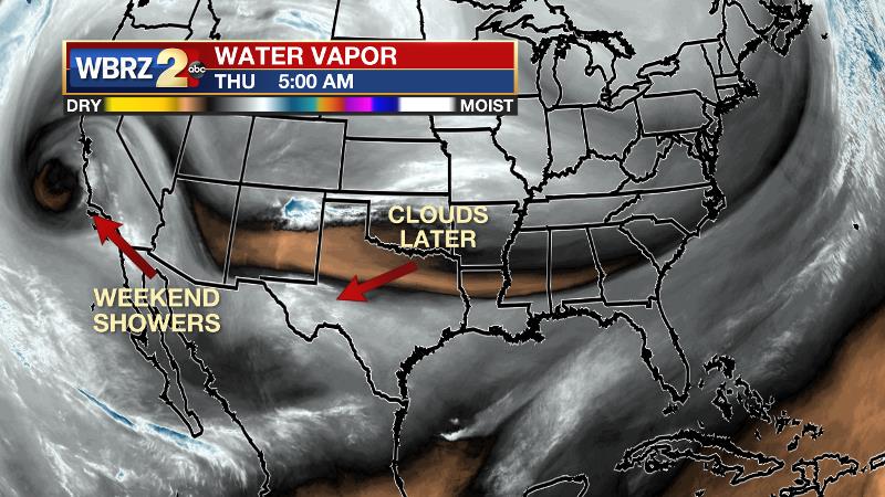
These disturbances will keep a good bit of mid and high cloud cover over the area for the next several days. There may be a few patches of light rain. These disturbances are difficult to time so any rain chances will be best defined about a day ahead in advance. Even though sunshine may be difficult find, onshore flow will cause temperatures to gradually moderate into early next week. Temperatures will actually go well above normal, especially Sunday through Tuesday, when readings will almost certainly average 10-15 degrees above average, with highs well into the 70s.
--Dr. Josh
The WBRZ Weather Team is here for you, on every platform. Your weather updates can be found on News 2, wbrz.com, and the WBRZ WX App. on Apple and Android devices. Follow WBRZ Weather on Facebook and Twitter for even more weather updates while you are on the go.
News
